
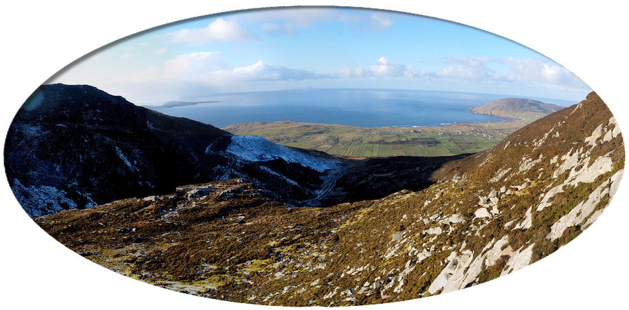
(Photograph by rakkar)
This is a compilation of records for Clonmany Parish and forms part of the Donegal Genealogy Resources Website
You may link to this page but not copy any of is content
If you have anything you'd like to add or would like to have yourself included in a Researchers section of these pages, then please Contact Me
![]()
Cluain Maine - Clonmany
CLONMANY, or CLUINMANAGH, a parish, in
the barony of ENNISHOWEN, county of DONEGAL, and province of ULSTER, 5 miles
(W. by N.) from Carne; containing 6450 inhabitants. According to Archdall, a
very rich monastery existed here, built by St. Columb in the 6th century, of
which there is now no trace, but the festival of that saint is observed on
the 9th of June. The parish, which is bounded on the north by the Atlantic
ocean, comprises 23 divisions, called quarter lands, and, according to the
Ordnance survey, 23,376 statute acres, two-thirds of which are irreclaimable
mountain land, and 127 1/4 are water. The shore forms a semicircle of nearly
nine miles, and abounds with sea-weed, which is used as manure. The
mountains, of which the largest is Raghtin, rising to an elevation of 1656
feet above the level of the sea, are chiefly composed of whinstone and
clay-slate, and near the pass to Desertegney a valuable deposit of limestone
has been recently discovered. In the mountain of Ardagh are veins of lead
ore, which have not yet been worked. The land is not generally favourable
for cultivation. There are three corn-mills. Fairs are held on Jan. 1st,
March 24th, June 29th, and Oct. 10th, for horses, cattle, sheep, flax, yarn,
&c. Within its limits are the rivers Clonmany and Ballyhallon: the former
has its rise in Meendoran lough, and the latter from a small spring in the
western part of the parish; they contain trout and eels, and in autumn,
salmon. Within the parish also is Dunaff Head, between which and Fanet
Point, in the parish of Clondevadock, is the entrance to Lough Swilly. On
Dunree Point an artillery station was erected in 1812, in which a small
garrison is still maintained. At Rockstown is a coast-guard station, and at
Strand, or Clonmany, one for the constabulary police. The principal seats
are Dresden, the residence of T. L. Metcalfe, Esq.; Glen House, of M.
Doherty, Esq.; and the glebe-house, of the Rev. Mr. Molloy.
The living is a rectory and vicarage, in the diocese of Derry, and in the
patronage of the Marquess of Donegal: the tithes amount to £400. The
glebe-house, which is on a glebe of five acres, was built in 1819, by aid of
a gift of £100, and a loan of £675, from the late Board of First Fruits: the
glebe at Cherbury comprises 365 acres, of which 300 are uncultivated. The
church is a neat structure, with a low square tower: it is situated in the
vale of Tallaght, and the Ecclesiastical Commissioners lately granted £368.
4. 3. for its repair. The R. C. parish is co-extensive with that of the
Established Church, and has a large and well-built chapel. The parochial
school is aided by an annual donation from the incumbent; and at Garryduff
is a very large and handsome school-house, built in 1835. There is a school
at Urras, aided by an annual donation from Mrs. Merrick, in which are
educated 35 boys and 17 girls; and there are four pay schools, in which are
170 boys and 30 girls. On the north-east of the parish are the ruins of a
castle, called Carrick-a-Brakey, consisting of a circular tower, 25 feet
high and 8 feet in diameter, and a square building, 30 feet high and 10 feet
in diameter. A mile south-east of this is another castle, called in Irish
Caislean na Stucah; it stands on a pyramidal rock, insulated by spring
tides, the top of which is 80 perches above the level of the sea, and is
inaccessible except by long ladders. Tradition states that, it was built by
Phelemy Brasselah O'Doherty. At Magheramore is a very perfect cromlech,
consisting of a table stone of above 20 tons, supported by three upright
pillars: it is called Fion McCuil's finger stone. Among the natural
curiosities is a chink in a rock at Tallaght, under which is a cavern: and
at Leenan Head is a beautiful cave, 70 yards long and 5 or 6 broad,
excavated by the sea, through which boats can pass; besides a waterfall
dashing over a perpendicular rock 50 feet high, and several caves. Here are
also some chalybeate springs; and on the lofty mountains eagles still build
their nests, and are very destructive, particularly in the lambing season.
(Extract from A Topographical Dictionary Of Ireland by Samuel Lewis, 1837)
![]()
Last updated 10 Aug 2019
Births, Marriages and Deaths
-
Baptisms
-
Births
-
Civil Birth Registrations Sep - Dec 1879
-
Marriages
-
RC Marriages 1852 - 1900
-
Sorted by Bride - Bride A-G Bride H-end
-
Sorted by Groom - Groom A-G Groom H-end
-
-
Deaths
-
Civil Death Registrations Jan - Mar 1865
-
Census
-
1740 Census
-
1841/51 Census
-
Census Search Forms/Old Age Pension Applications
-
-
1901 Census
-
1911 Census
Churches
Commercial Directories
Families
- The Devlin Family (Daniel Devlin)
Famine
Headstone Inscriptions
- Devlin Headstone Inscriptions
- Old Church, Straid
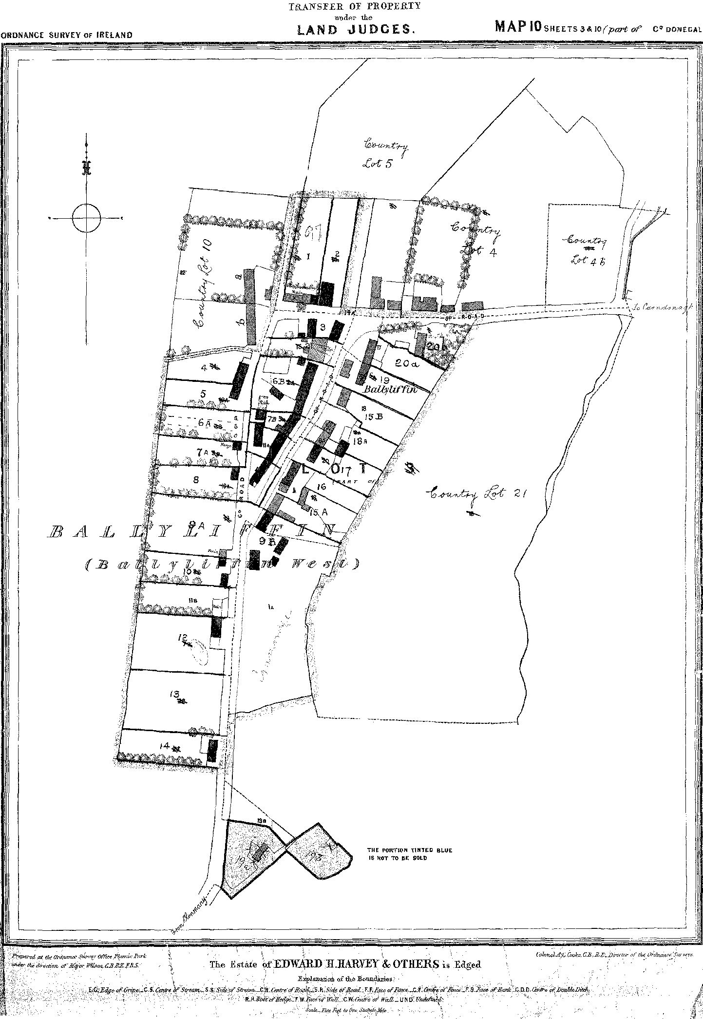
Land
- 1665 Hearth Money Roll
- 1796 Spinning Wheel Premium Entitlements List (Flax List)
- 1800 Donegal Supporters of the Act of Union (Clonmany)
- 1826 Tithe Applotment Book
- 1827-33 Civil Bill Ejectments
- 1829-31 Applications to Register Freeholds in the Barony of Ennishowen
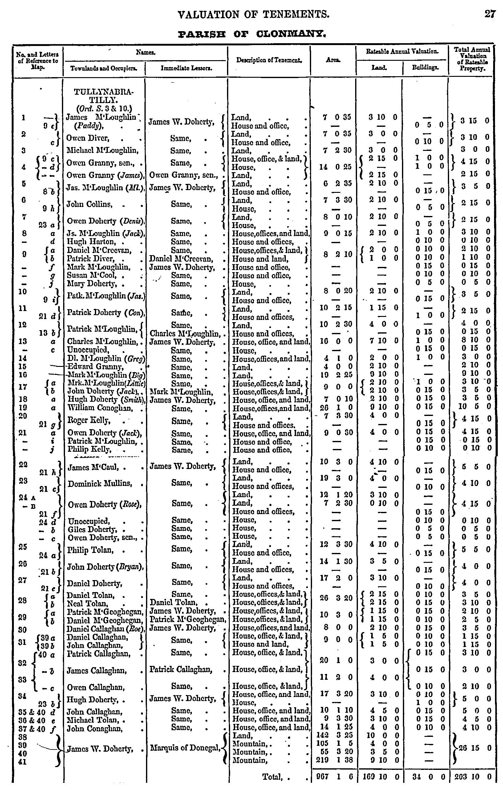
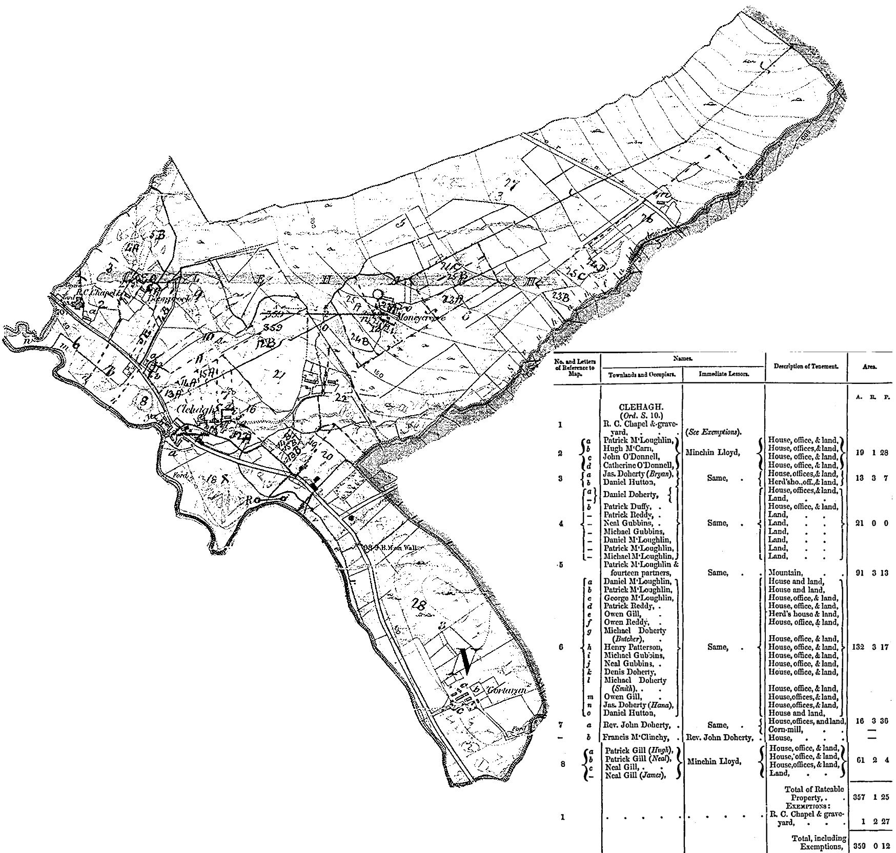
- 1857 Griffith's Valuation - heads of households and townlands
- 1857 Griffith's Valuation - detailed:
- 1857 Griffith's Valuation online
- 1876 Land Owners
Links