

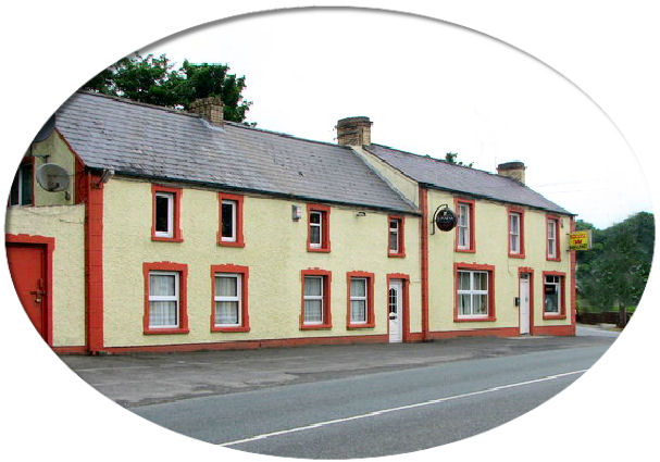
(Redcastle Pub. Photograph by Willie Duffin)
This is a compilation of records for Moville Upper Parish and forms part of the Donegal Genealogy Resources Website
You may link to this page but not copy it
If you have anything you'd like to add or would like to have yourself included in a Researchers section of these pages, then please Contact Me
![]()
Maigh Bhile Uachtarach - Moville Upper
MOVILLE (UPPER), a parish, in the barony of ENNISHOWEN, county of DONEGAL, and province of ULSTER, 15 miles (N. N. E.) from Londonderry, on the road to Greencastle; containing 4902 inhabitants. St. Patrick founded a monastery here, called Maghbhile and Domnachbhile, over which he placed AEngusius, the son of Olild; it soon became celebrated for its wealth, and notices of its abbots occur from the year 590 to 953, among whom was the celebrated St. Finian. The remains are called Cooley, meaning "the City," probably from a large number of persons having settled around this famous pile, which appears, from what is left of the western and southern walls, to have been a very extensive edifice. For some time before the reformation it was used as the parish church, and so continued until destroyed during the civil war of 1688. In the adjoining cemetery is a very ancient tomb, said to be that of St. Finian; and outside the walls stands a very lofty and handsome stone cross, hewn out of one block, and in good preservation. These ruins occupy a gentle eminence, near the shores of Lough Foyle, commanding a full view of the Atlantic. The parish, which is situated on the western shore of Lough Foyle, comprises, according to the Ordnance survey, 19,081 3/4 statute acres: one-half is mountainous, and the remainder consists of good and middling arable land with detached pieces of bog scattered all over the parish. The land is generally light, and everywhere encumbered by rocks, heath, and whins; the greater portion of the rocks are clay-slate. Near Whitecastle is excellent sandstone, and there are strong indications of coal, near which is a curious and extraordinary whin dyke. Here the system of rundale is still kept up, and the land, being divided into very small holdings, is much neglected, nearly all the population being employed in the weaving of linen cloth and fishing, combined with agricultural pursuits: the produce of the land is chiefly corn and flax, wheat having only been grown since 1830, but it is found to answer very well. The parish is within the jurisdiction of the manor court held at Greencastle. The principal seats are Red Castle, the residence of Atkinson Wray, Esq.; White Castle, of L. Carey, Esq.; Foyle View, of R. Lepper, Esq.; Greenbank, of J. Robinson, Esq.; Ballylawn, of S. Carmichael, Esq.; Beech Cottage, of the Rev. A. Clements; and the Glebe-house, of the Rev. J. Moles-worth Staples. The living is a rectory, in the diocese of Derry, forming the corps of the prebend thereof, in the patronage of the Bishop; the tithes amount to £555. The glebe-house was built in 1775, at a cost of £590, by the then incumbent; the glebe comprises 74 Cunningham acres, valued at £66. 12. 0 per annum. The church is an ancient, small, and inconvenient edifice, oil the shore of the lough; it was built by the Carey family, in 1741, as a private chapel, and afterwards became a chapel of ease, and eventually the parish church; but, being much too small, a larger is about to be erected. In the R. C. divisions this parish and Lower Moville form the union or district; there is a chapel at Drung. Near Castle Carey is a very neat meeting-house for Presbyterians in connection with the Synod of Ulster. About 400 children are educated in seven public schools, of which the parochial school at Ballylawn is being rebuilt; it is partly supported by the rector, and with five other schools, is in connection with the National Board; the school-house of one of the latter, at Terryroan, was erected by the Earl of Caledon, and the rector contributes £5 per ann. for its support. There are also four Sunday schools. Not far from Drung are eight upright stones, near which are several lying down, the remains of an ancient cromlech. Part of a fosse and some terraces and remains of former mansions are to be traced near Red and White castles, and at Castle Carey.
(Extract from A Topographical Dictionary Of Ireland by Samuel Lewis, 1837)
![]()
Last updated 10 Aug 2019
Births, Marriages and Deaths
-
Baptisms
-
Births
-
Marriages
-
Deaths
Books
Census
-
1740 Census
- 1841/51 Census
- Census Search Forms/Old Age Pension Applications
-
1901 Census
-
1911 Census
-
1911 Roosky - McLaughlin Households
Churches
- Church of Ireland
- Presbyterian
- Roman Catholic
Families
Headstone Inscriptions
Land