

The following is a compilation of records on Gweedore, which forms part of the Donegal Genealogy Resources Website
You may link to this page but not copy it
If you have anything you'd like to add or would like to have yourself included in a Researchers section of these pages, then please Contact Me
Gweedore is a district in the Donegal Gaeltacht to the south of Bloody Foreland in the extreme north-west of Ireland. It is secluded in a wasteland of blanket bog beyond the bold quartzite cone of Errigal. Although the Parliamentary Gazetteer of 1844
briefly dismisses Gweedore as 'the name of a rivulet, a bay and a wretched fishing hamlet', the name is now applied to an extensive district lying between Cloghaneely to the north-east and the Rosses to the south-west. It is also the name of a
Roman Catholic parish established in the 1830s.
Nineteenth-century visitors describe the area as one of desolate savagery, and even today, once one leaves the densely-settled coast road, it is singularly wild and empty, consisting mostly of blanket bog. Much of the cultivated land is reclaimed from peat and
boulders, and along the coast rock exposures alternate with sand dunes. Inland it culminates in the naked hill mass of Tievelehid. Granite underlies most of the area, and the higher hills are composed of resistant quartzite, but patches of schist occur in some of the river valleys, and thin bands of ancient limestone bring relative fertility to parts of the Clady valley.
Like most of Donegal it was classified as a congested district in 1891, and today it is near the heart of the Donegal Gaeltacht. Settlement clings to the lowlands below about 250 feet, and the whole coastal strip from the Bloody Foreland to the Gweebarra River is thickly settled, with population densities probably exceeding 300 people per square mile of cultivated land: in 1891 the figure reached 400. There were no roads fit for wheeled vehicles until 1834, when the Board of Works completed the road to Gweedore River from Dunlewy: the bridge was built in 1840.
It is doubtful if there was much permanent settlement in Gweedore until recent centuries - there are a few early Christian sites in the area, including the remains of a medieval church on the machair at Magheragallan, but it seems likely that intensive settlement began
with refugee movements from the east, associated with the Ulster plantations of the seventeenth century.
The 'Distress' and Immigration
Against this background there played a tragic drama which was especially documented during the 1850s. The following links will take you to extracts of original documentation concerning the plight of the people of Gweedore during that period - pleas for assistance, reports of conditions, and thankfully (for family historians) records of individuals, where no other record exists except this, which details their distress.
Acknowledgements
I would like to thank Tim O'Sullivan for offering his research into the Distress, without which, this would be a very small project! Please be sure to read his History of Gweedore, below, for essential background information.
And, if any your research interests include the Peoples family of Gweedore, please email Tim.
I would also like to thank Margaret Bonar for the 28 Census Extractions below. Her Census extractions are part of a Mini Thesis for the completion of the Certificate Course in Genealogy at the University College,
Dublin, undertaken by Margaret. Tutor Sean Murphy MA.
Last Updated 10 Aug 2019
Births, Marriages and Deaths
Baptisms
Births
Marriages - Civil Registrations
Marriages - Roman Catholic
Gweedore Marriages 1855 - 1916 (178 entries - civil registration) (Margaret)
Marriages at St Mary's Tullaghobegly/Gweedore 1866 - 1876 (234 entries - RC church register)
Deaths
Census
- 1841/51 Census
- Census Search Forms/Old Age Pension Applications
1901 Census
- 1911 Census
Churches
Documents Relating to the Distress in Gweedore and Cloughaneely 1850s:
History of Gweedore - Chapter One (Tim O'Sullivan)
History of Gweedore - Chapter Two (Tim O'Sullivan)
History of Gweedore - Bibliography (Tim O'Sullivan)
The Memorial of Paddy McKye (Facts from Gweedore, 1845)
Gweedore and Cloghaneely Appeal 1858 (Various newspapers, 1858)
Minutes of evidence taken before the Select Committee into Destitution in Gweedore and Cloughaneely (Tim O'Sullivan)
List of houses in each townland, and the number of family in each house visited by Rev. J. McGroarty, 17th June 1858 (Tim O'Sullivan)
List of houses visited by William Robertson on Lord George Hill's property in company with Mr Cruice, the Stipendiary Magistrate, on the 16th June 1858 (Tim O'Sullivan)
List of persons visited in Gweedore, June 1858 (Tim O'Sullivan)
Report from the Select Committee on Destitution (Gweedore & Cloughaneely) 1858 (full report, readable online)
Documents Relating to the Evictions in Gweedore 1880s:
Report of the Gweedore Evictions 1886 from the Derry Journal Newspaper (Sheila Connolly)
Events in Gweedore:
Headstone Inscriptions:
Land Records:
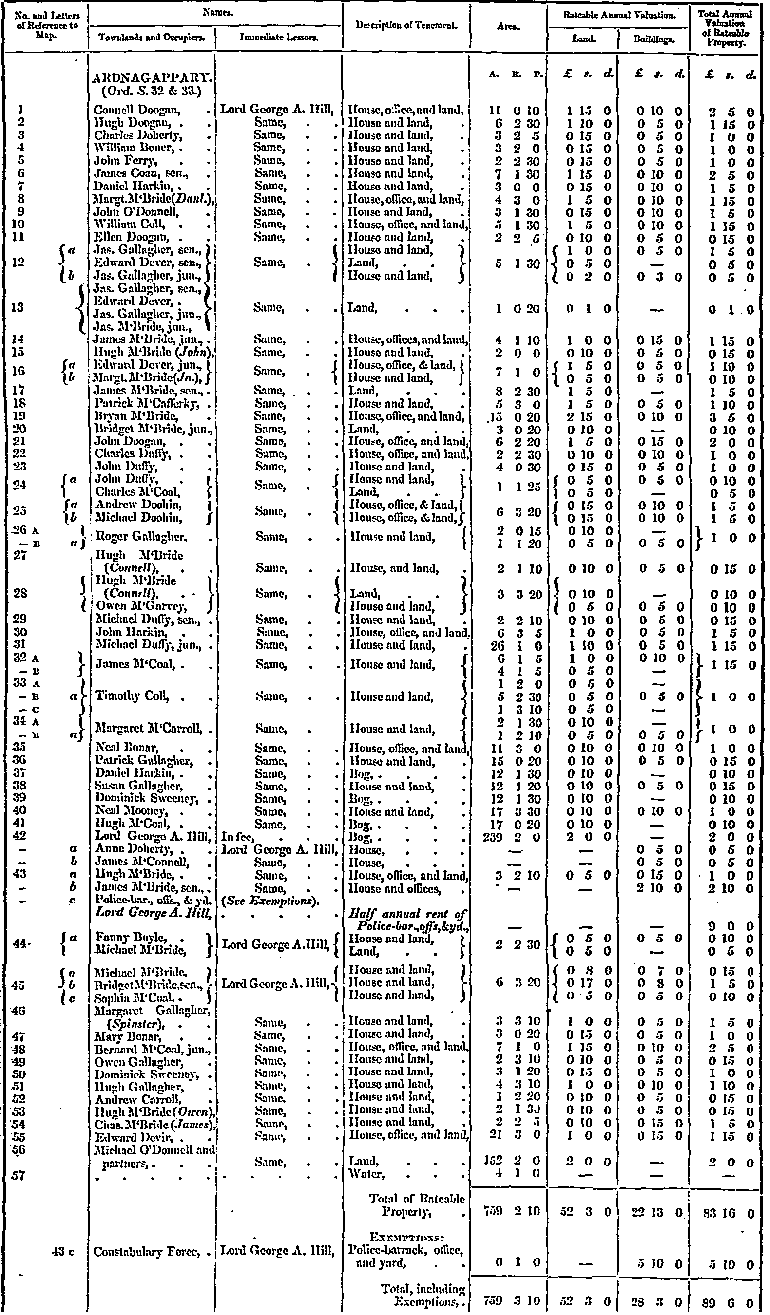
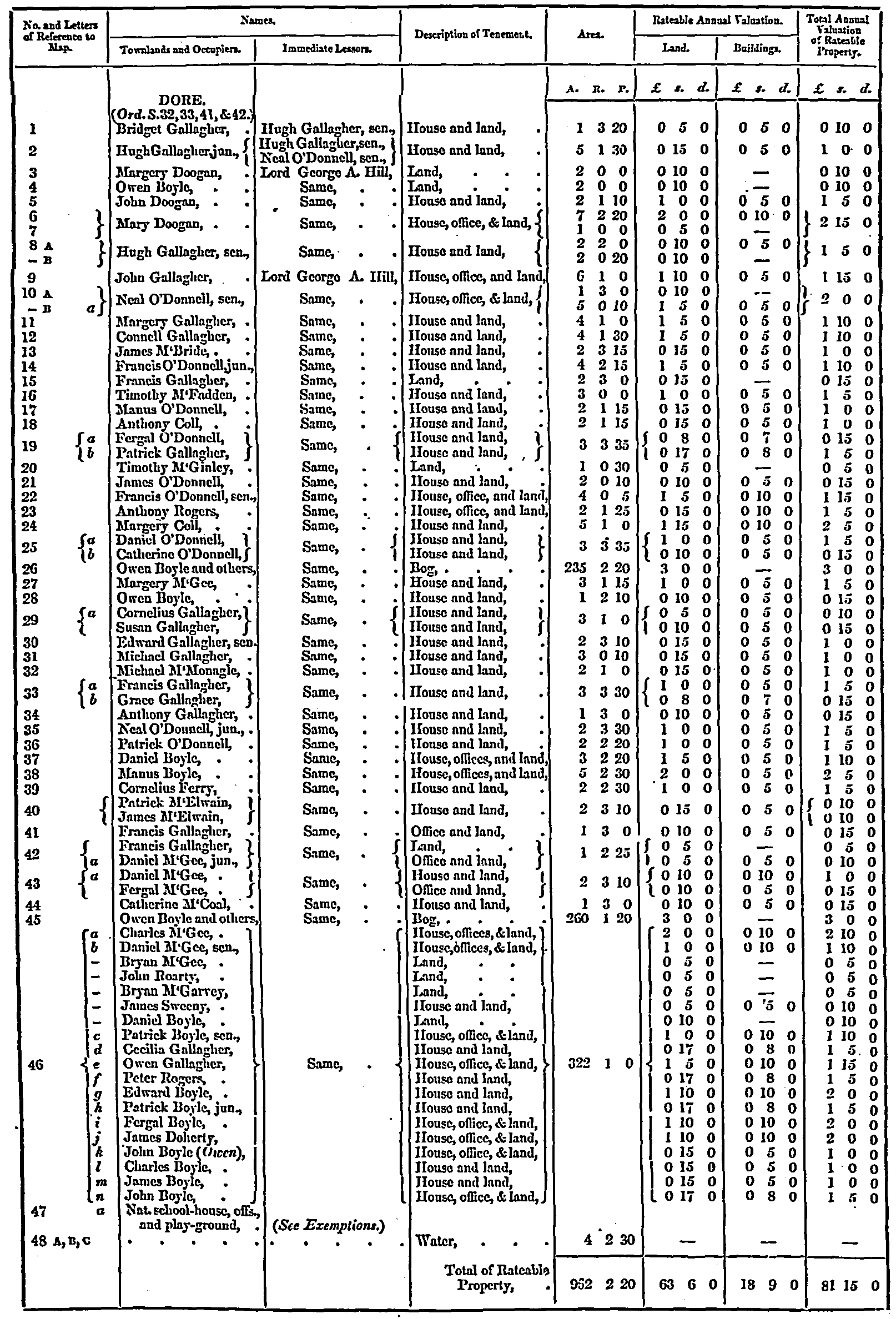
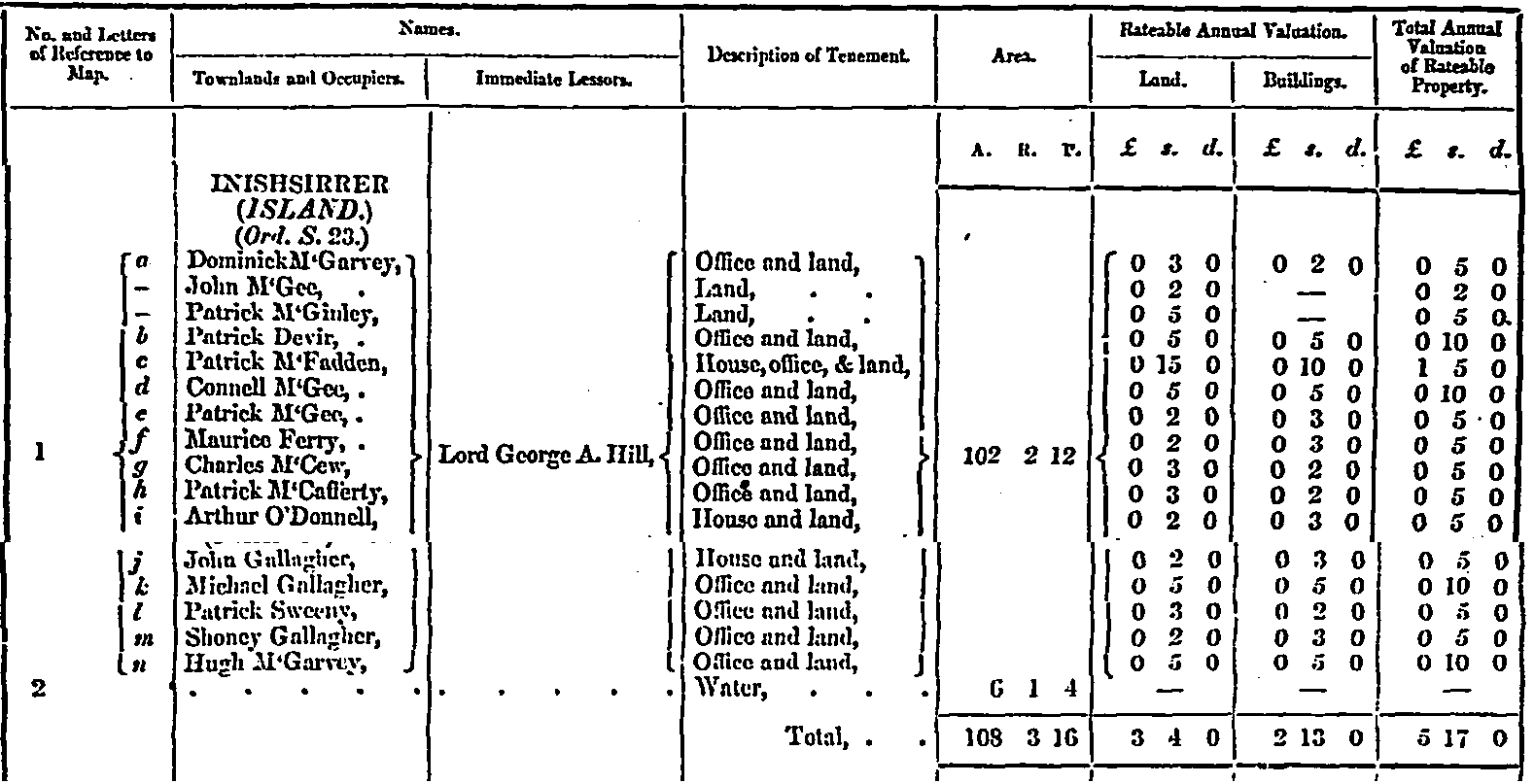
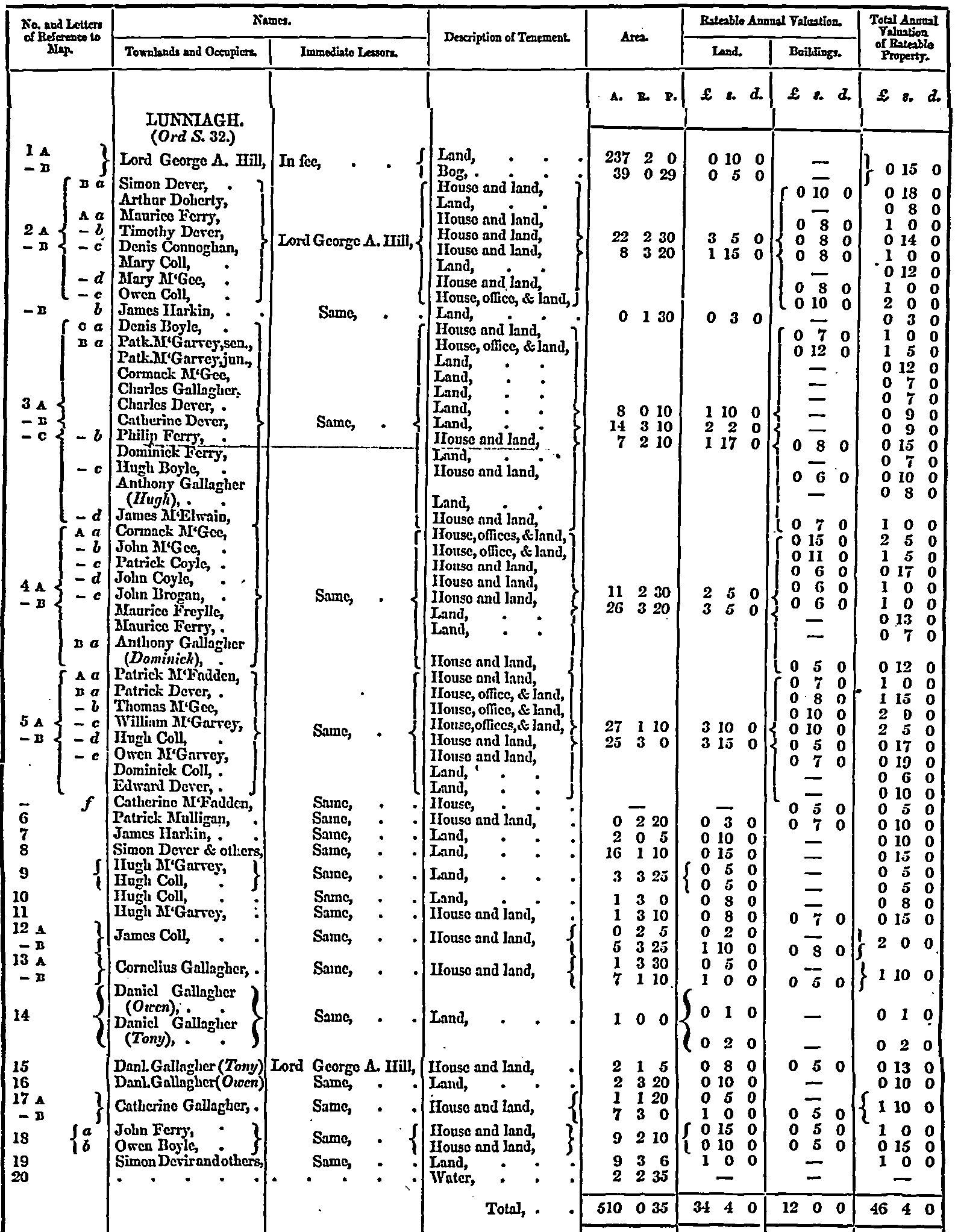
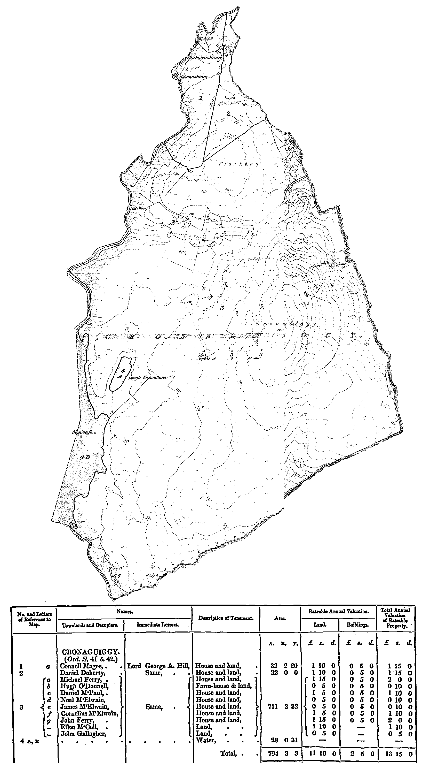
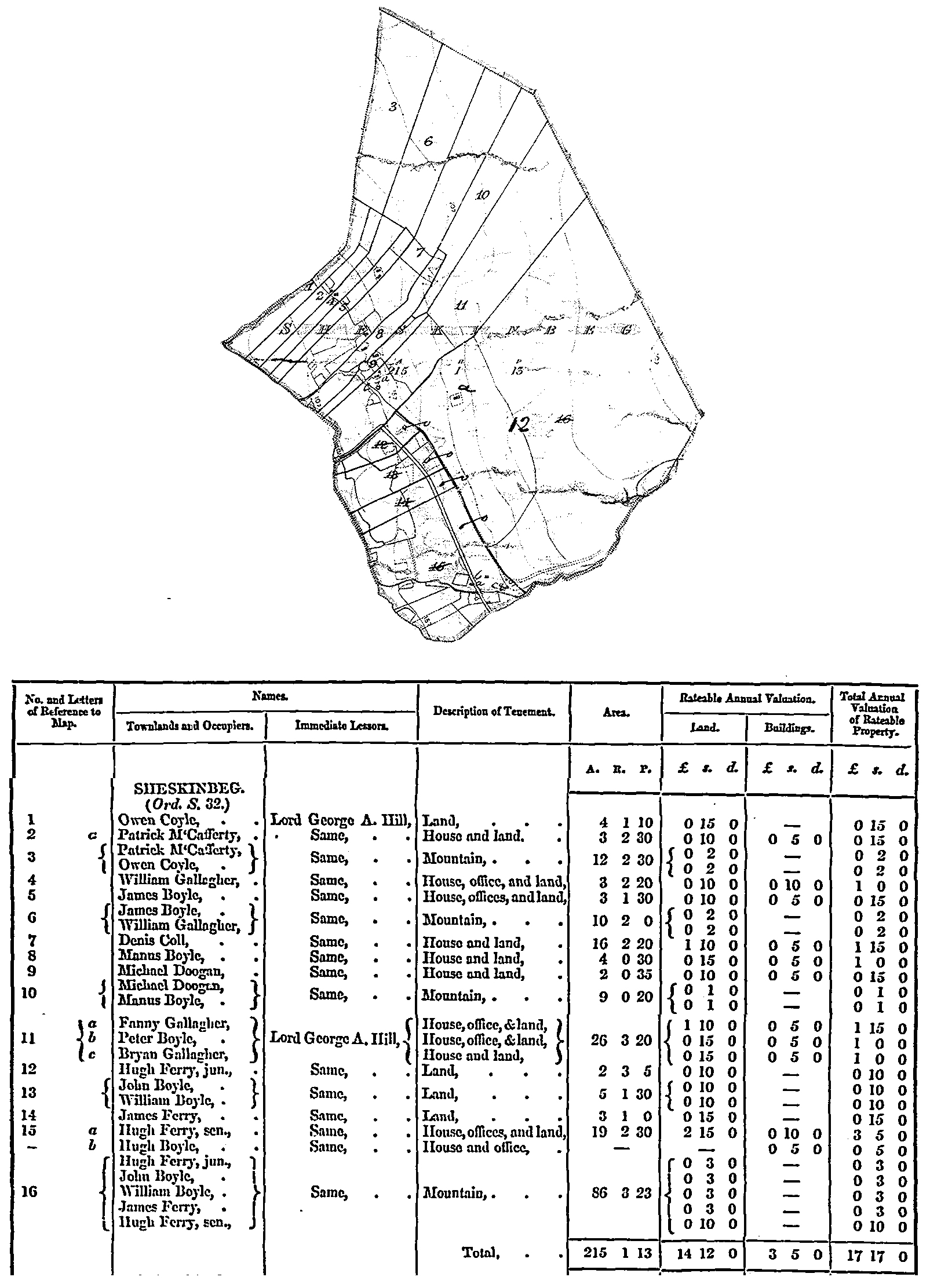
Griffith's Valuation
Gweedore tenants referred to in the judgement of the Irish Land Commission which sat in Bunbeg in July 1885 (Tim O'Sullivan)
Gweedore Estate, Sales of Tenant right from 1882-1886 (Tim O'Sullivan)
Links:
Gaoth Dobhair - A new website about Gweedore/North West Ireland by Annemiek
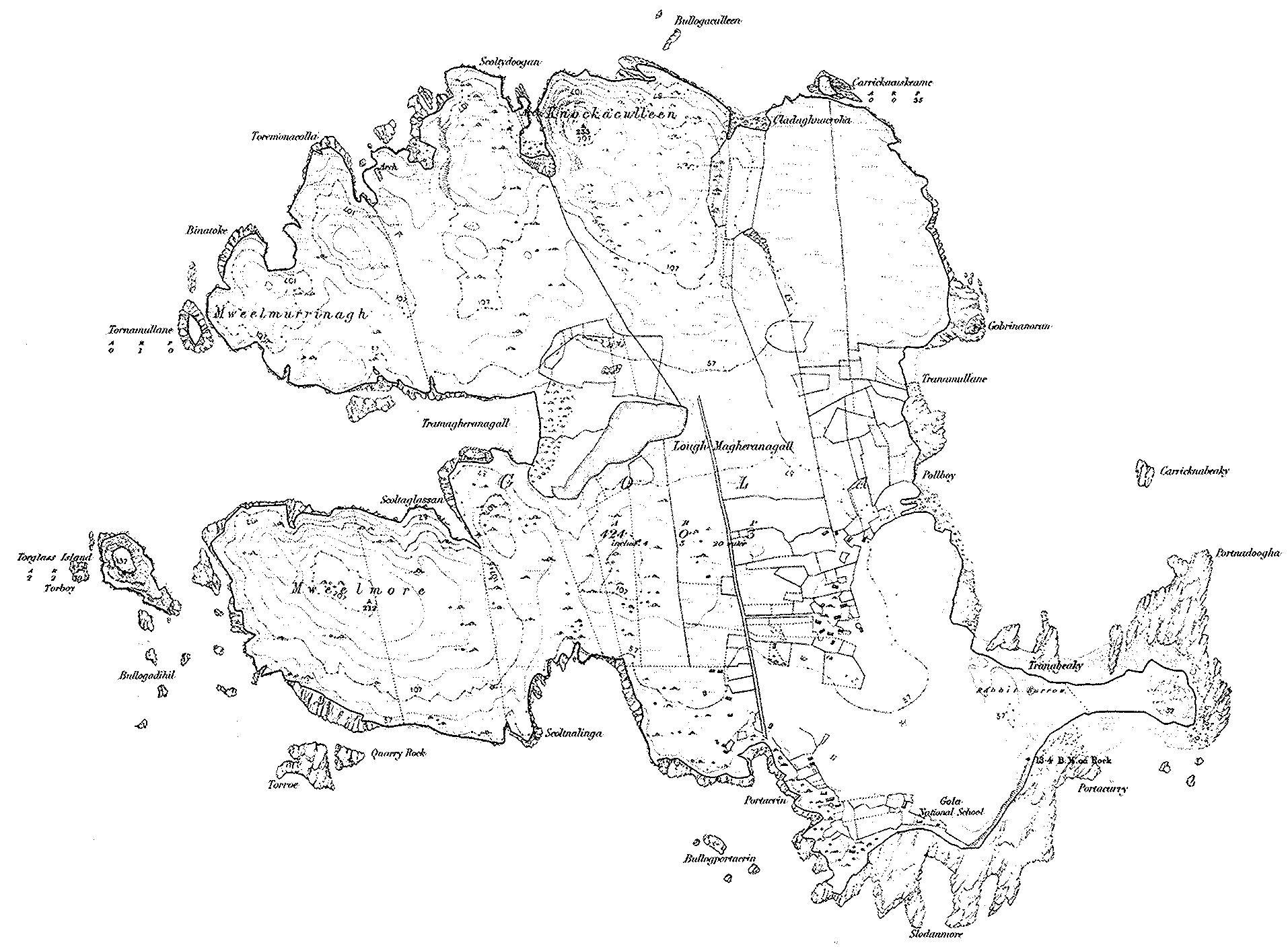
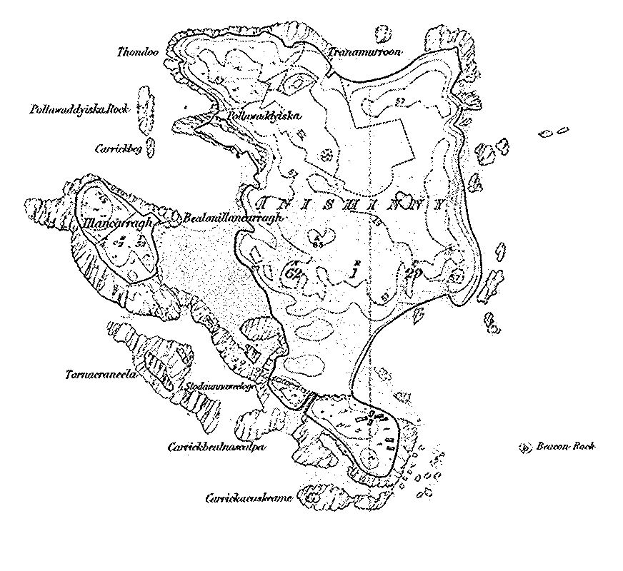
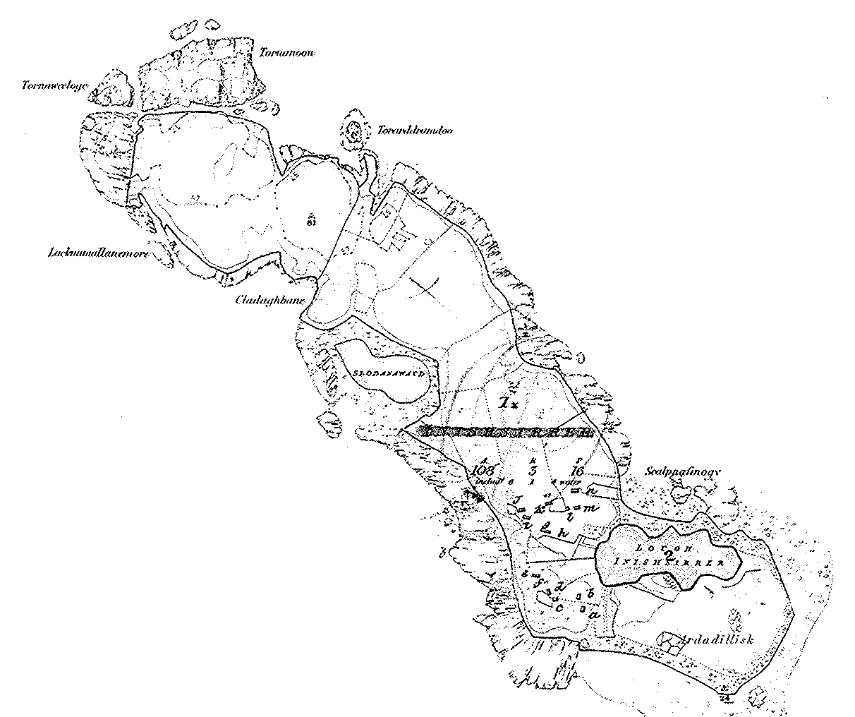
Maps:
Ordnance Survey 1835
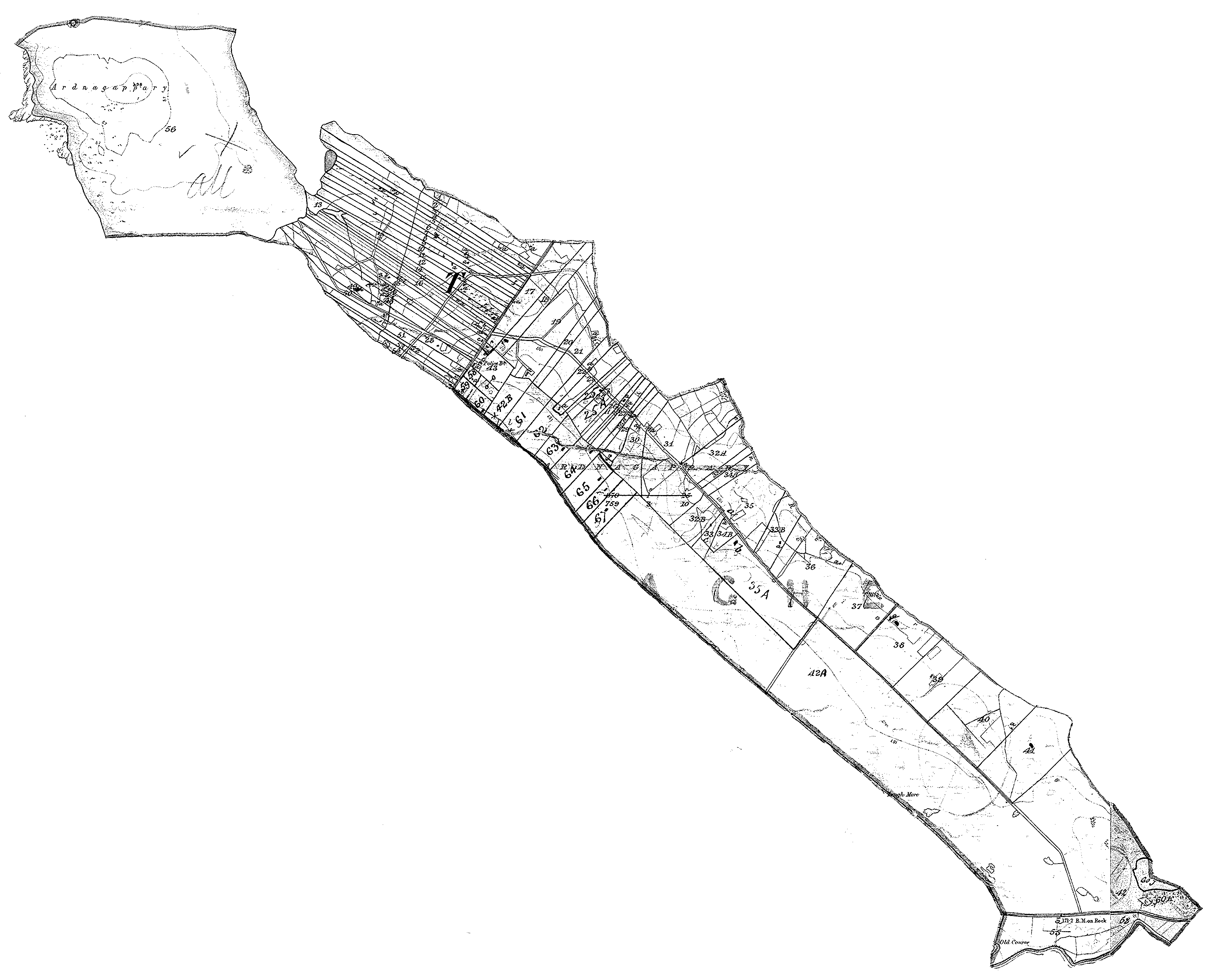
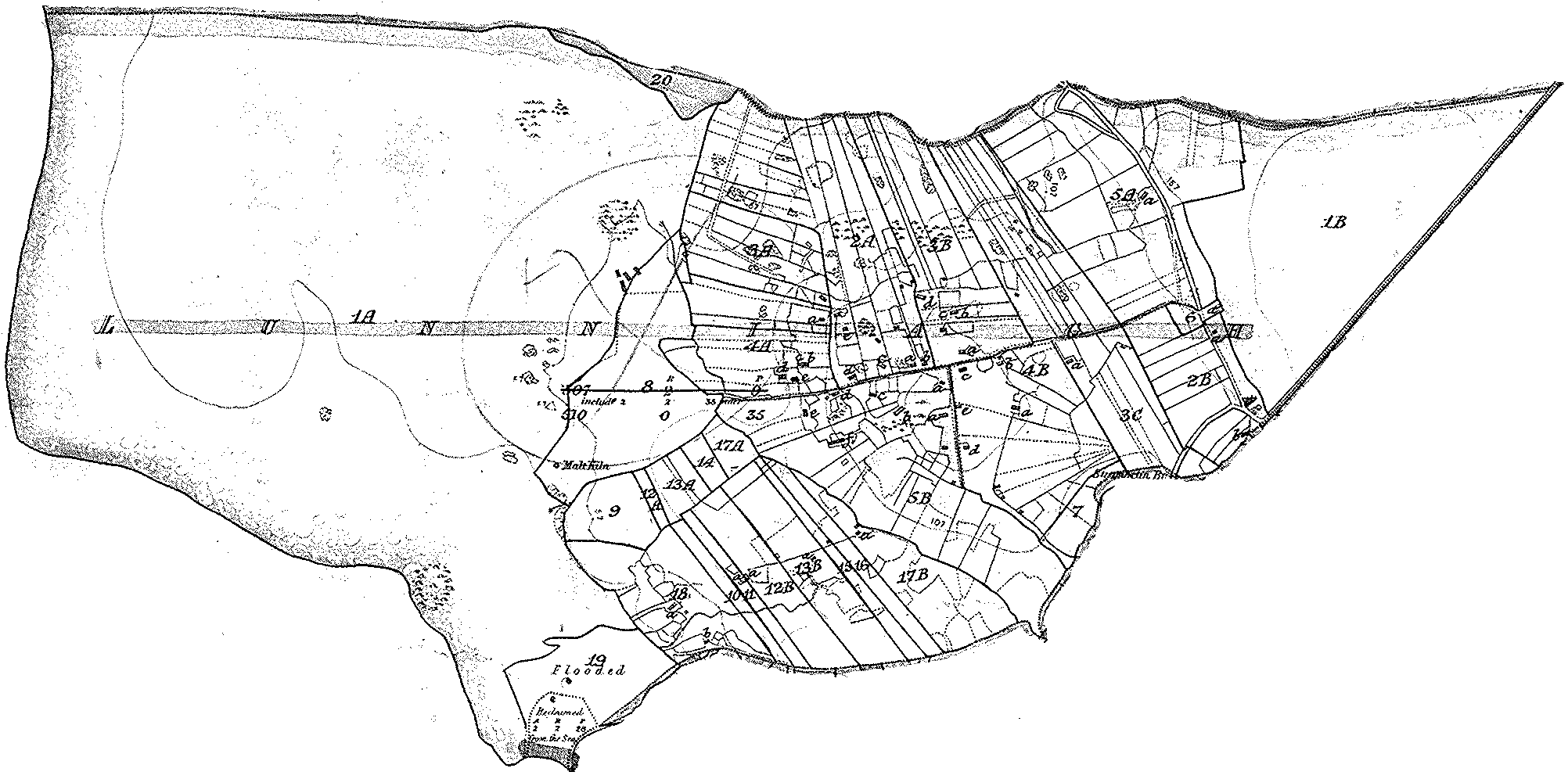
Ardnagappery (with Griffith's Valuation refs - see Valuation above)
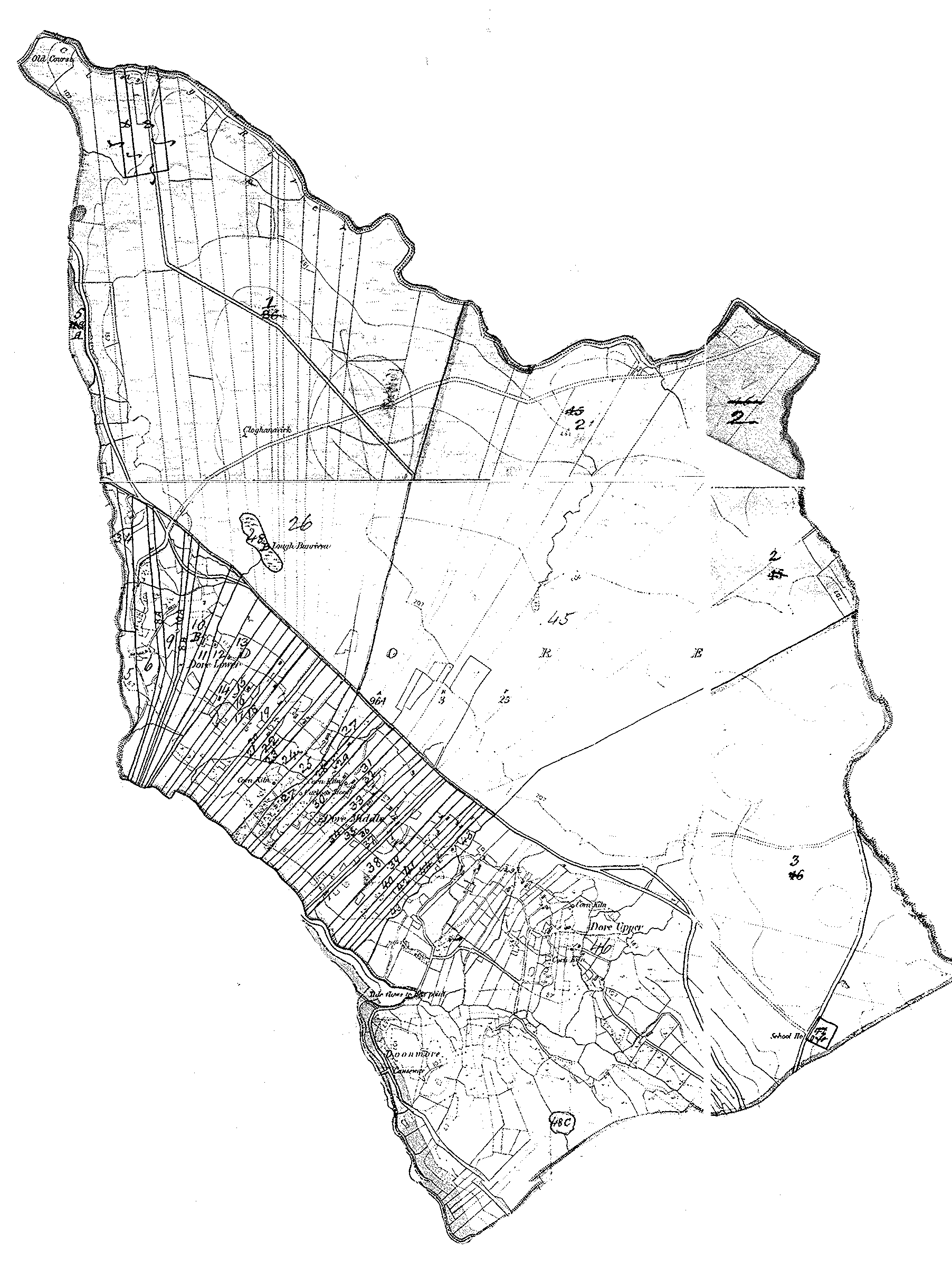
Dore (with Griffith's Valuation refs - see Valuation above)
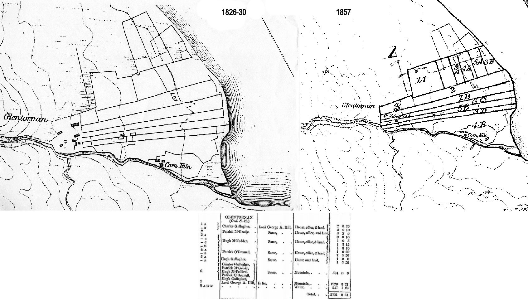
Glentornan (Bernard)
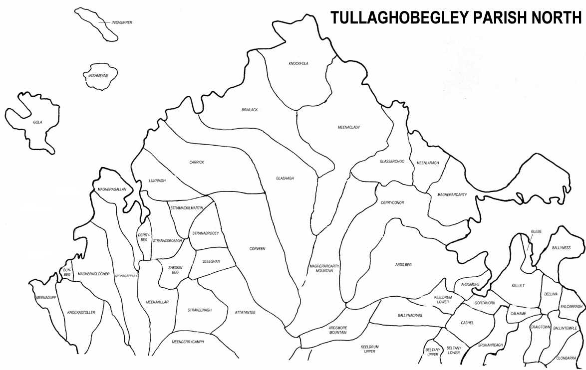
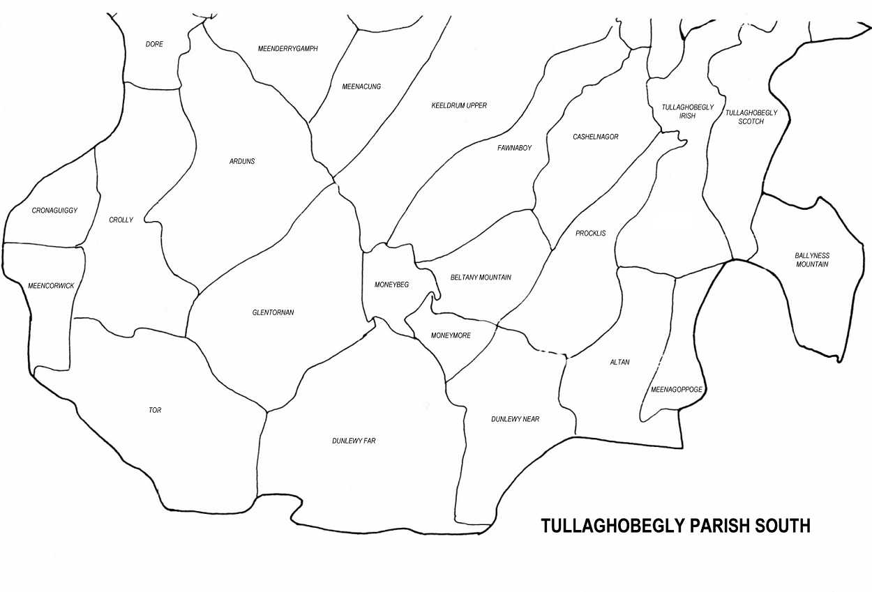
Parish
Media:
Music/Video:
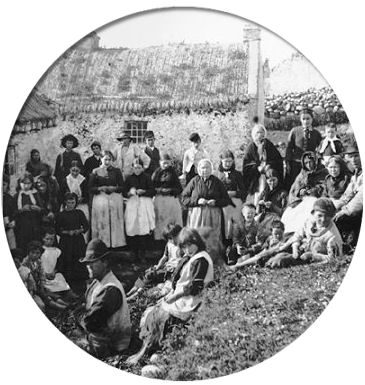
Photographs:
Registers:
:
© 1998 Donegal Genealogy Resources