
This is a compilation of records for Tullaghobegly Parish which forms part of the Donegal Genealogy Resources Website
You may link to this page but not copy any of is content
If you have anything you'd like to add or would like to have yourself included in a Researchers section of these pages, then please Contact Me
Tulacha Beigile (Thulacha Beigile) - Tullaghobegly
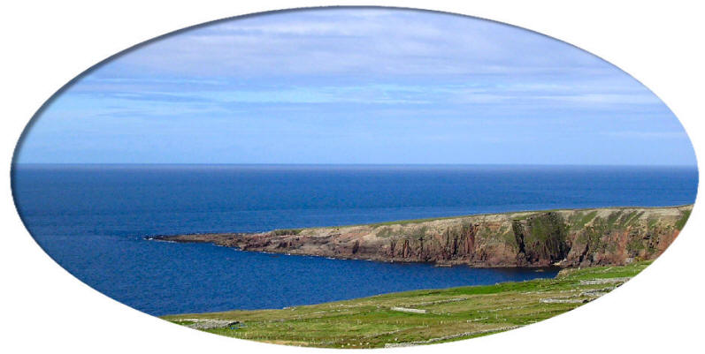
A parish, in the barony of KILMACRENAN, county of DONEGAL, and province of ULSTER, 7 miles (S. W.) from Dunfanaghy, on the north-west coast, and on the rivers Gwidore and Clady; containing 8464 inhabitants. For civil purposes it is divided into east and west; the former contains 5202, and the latter 3262, inhabitants. It is said to derive its name from Tully O'Bigley, who founded a monastery here, of which the remains exist. According to the Ordnance survey it comprises 68,608 statute acres, of which 785 are in Tory Island, 92 1/2 in the tideway of the Gwidore, and 1720 in small loughs; 19,811 are applotted under the tithe act. About one-fourth of the entire superficies is arable, and the remainder mountain and bog; agriculture is but little improved. Within the limits of the parish are the district of Cloghanheely and part of that of the Rosses; and the islands of Tory, (about two leagues to the north-east), Innisboffin, Island Dowey, or Innisduck, (comprising about 20 acres of arable and pasture and a quantity of mountain land), Innisbeg, Inisinney, and Innismanan, of which the two first are inhabited, and the rest only during the summer; also Bloody-Foreland-Point, in lat. 55°. 8'., and lon. 8°. 17'.; and the mountains of Errigal, 2462 feet, Carntreena 1396 feet, and Bloody-Foreland 1035 feet, above the level of the sea. In the Rosses, at a place called Rosapenna, so lately as 1784, the district was well cultivated, planted and improved, particularly around the mansion of Lord Boyne, whose demesne excited general admiration; but now the house, park, garden and even the tallest trees are covered with sand blown in from the Atlantic; even the chimneys are only visible at times, and, added to this, 1400 acres of land lie buried beneath the sand, which is every year increasing. On the townland of Tullaghobigley iron ore has been found in large lumps; and in the Errigal mountain, extensive lead mines, belonging to the Earl of Leitrim, have been successfully worked, but are at present abandoned. Fairs are held at Gortahock on the first Tuesday, at the Cross Roads the last Thursday, and at Derrybeg on the last Monday in every month, but they are only indifferently attended. The gentlemen's seats are Cashel, the residence of R. Johnston, Esq.; and Dunloey, of Capt. Dambrene, where is a fine marble quarry. The living is a rectory and vicarage, in the diocese of Raphoe, and in the patronage of the Bishop: the tithes amount to £220, and the glebe comprises 40 acres, valued at £30 per annum. The roof of the church fell in in 1834, which having left it a ruin, divine service is now performed in the rector's house. In the R. C. arrangements the parish is divided into East and West Tullaghobigley, the former being united to the parish of Raymunterdoney: the chapel at Gortahork, in the eastern division,
is a large slated building, erected about 50 years since; and at Cottern, in the western division, is a chapel, which has been built 87 years. The parochial school, in which are about 50 children, is aided by an annual donation from Col. Robertson's fund: there are also five
private schools, in which are about, 80 children. At Maghragallan are the ruins of an old church and a burial-ground.
(Extract from A Topographical Dictionary Of Ireland by Samuel Lewis, 1837)
Last updated 7 Jul 2020
Also see:
Births, Marriages and Deaths
Births/Baptisms
Civil Registrations
Civil Birth Registrations (1864 - 1881, 719 entries, not complete) (Cass)
Roman Catholic
Baptism Records 1849-1861, Old St. Mary’s Church, Held at Christ the King Church (Gortahork) (Roseann)
Master index to online Gweedore births and baptisms (1,707 entries - go to Gweedore for the full entries) (Margaret)
Marriages
Civil Registrations
Roman Catholic
Gweedore Marriages 1855 - 1916 (178 entries - civil registration) (Margaret)
Marriages at St Mary's Tullaghobegly/Gweedore 1866 - 1876 (234 entries - RC church register)
Deaths
Census Extractions:
1841/51 Census
Census Search Forms/Old Age Pension Applications
1901 Census
1901 Ballyness Mountain
1901 Gola Island updated
1901 Magheragallen updated
1901 Stranabrooey updated
1901 Stranacorkeragh updated
1911 Census
Indexes
Surname extractions
Churches
Church of Ireland
Roman Catholic
Events
Headstone Inscriptions:
Gortahork (partial) (Roseann)
St Ann's Church of Ireland (Killult) under construction
Tory Island (Roseann)
Tullaghobegley Graveyard being updated
Land Records:
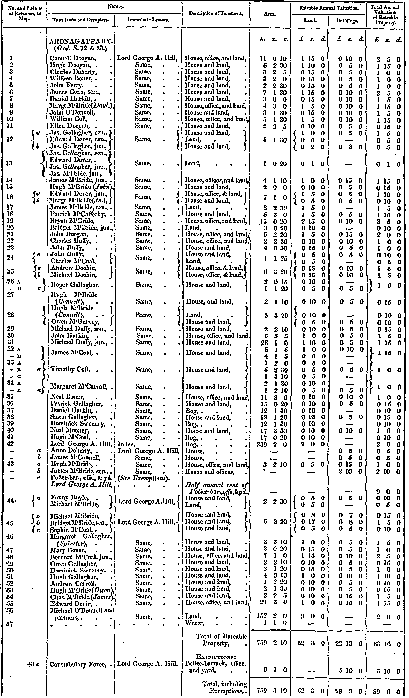
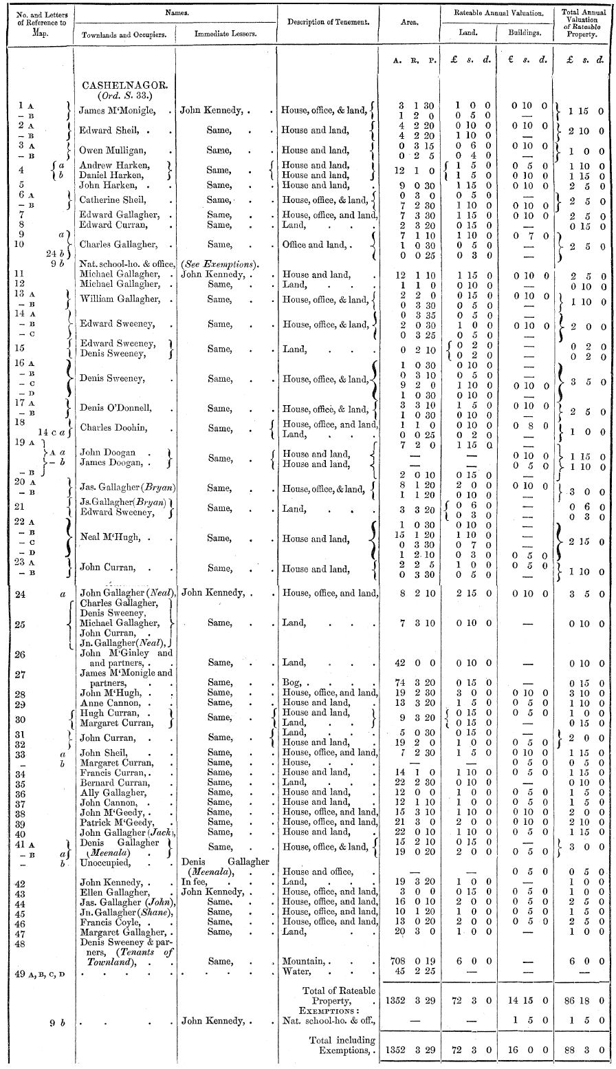
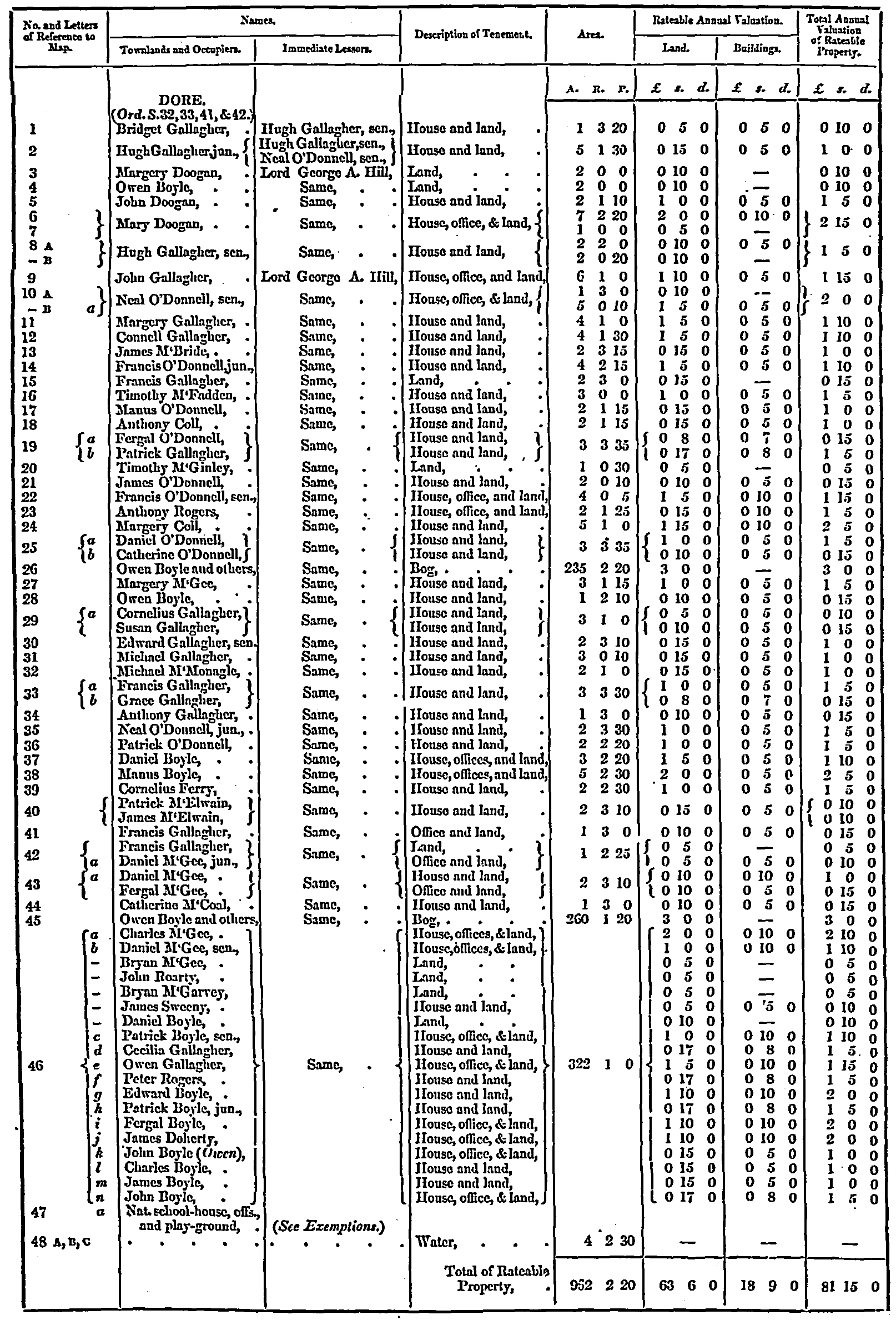
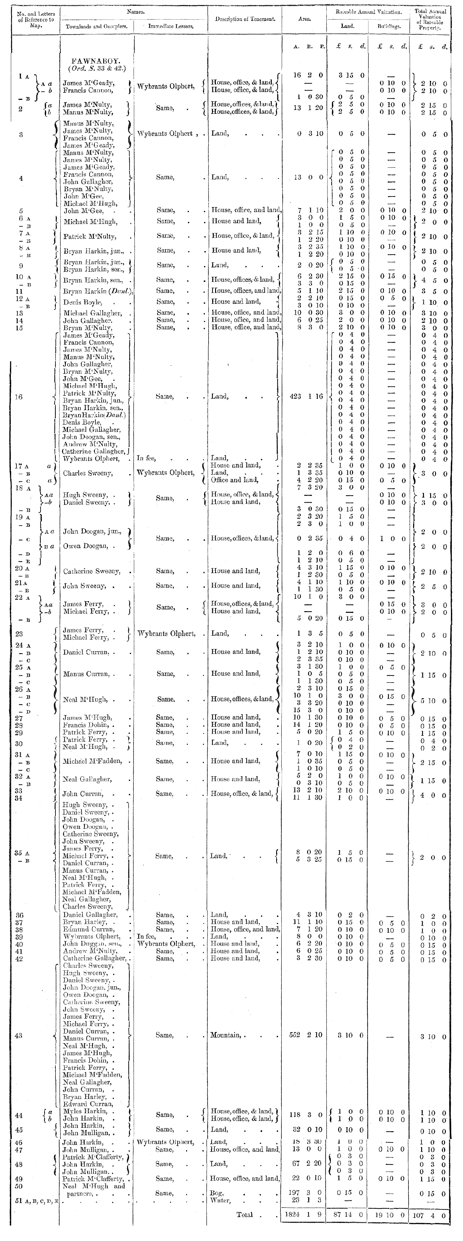
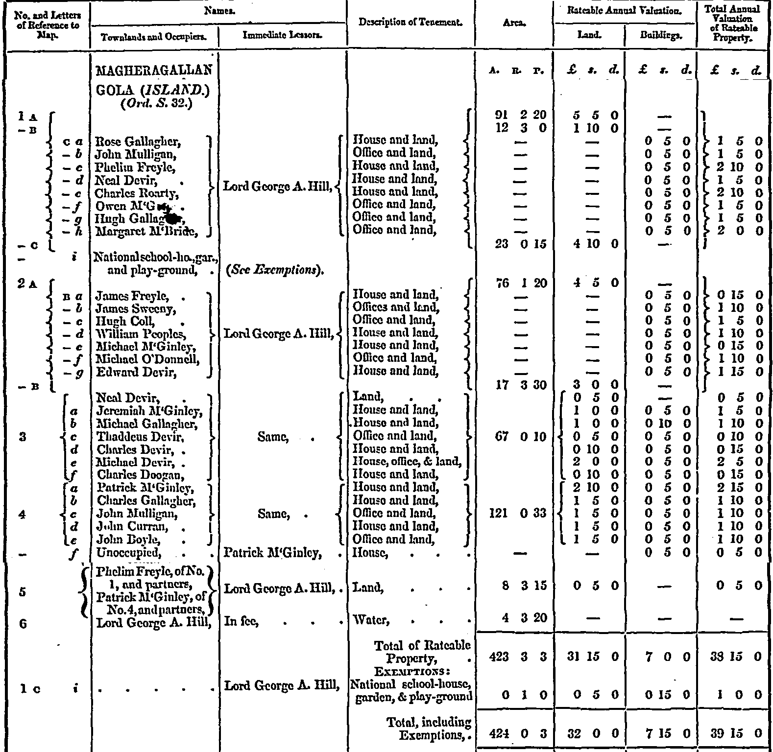
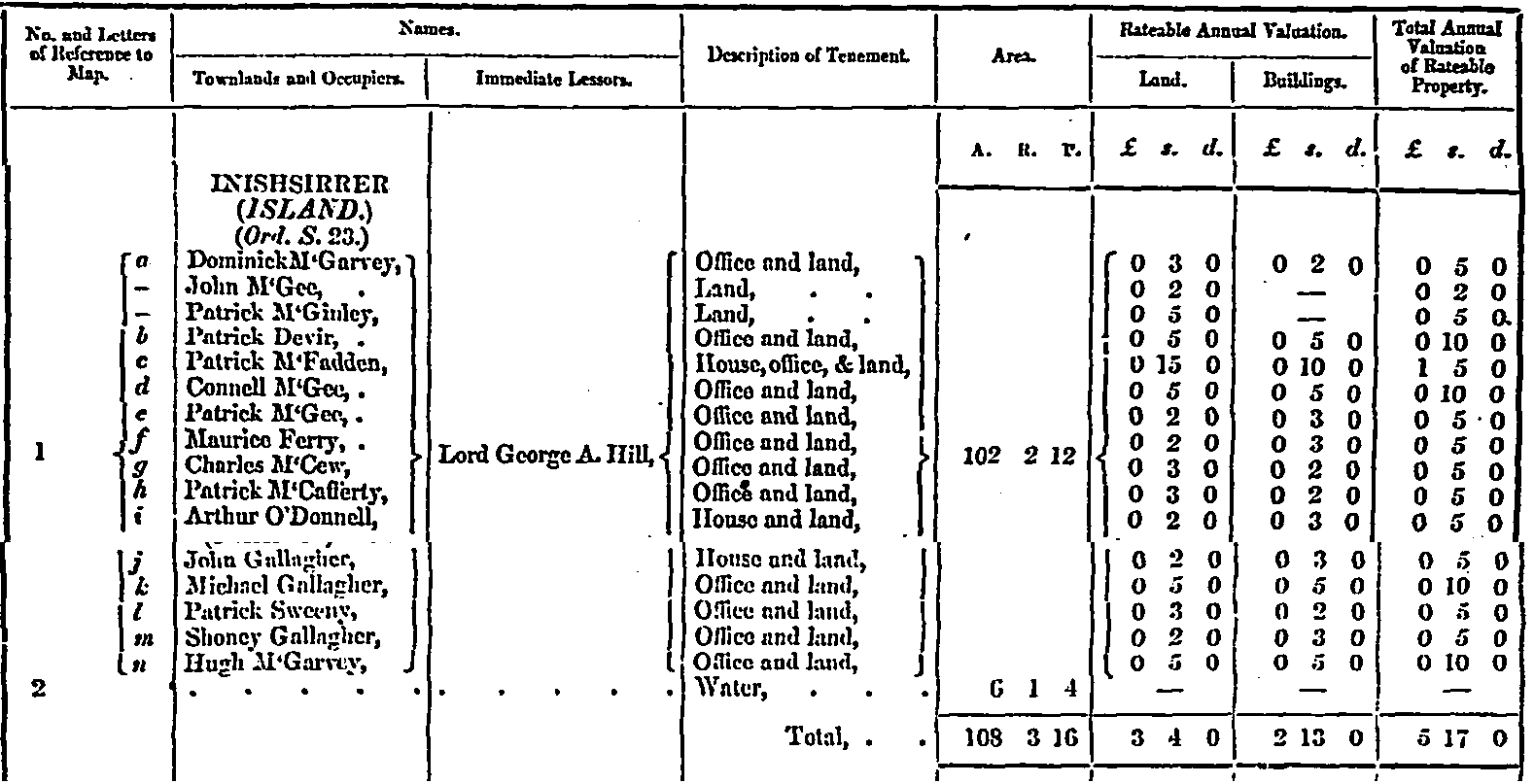
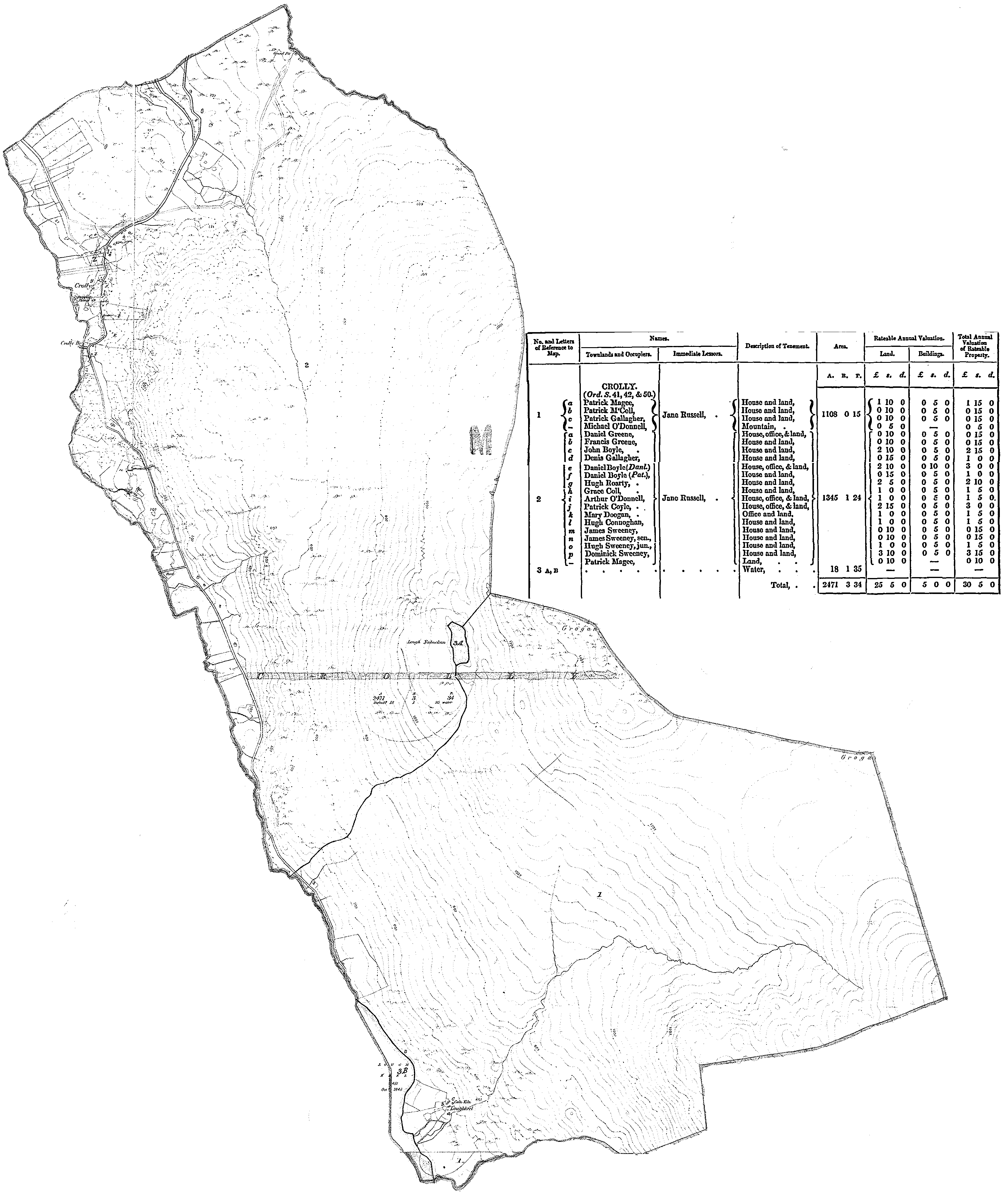
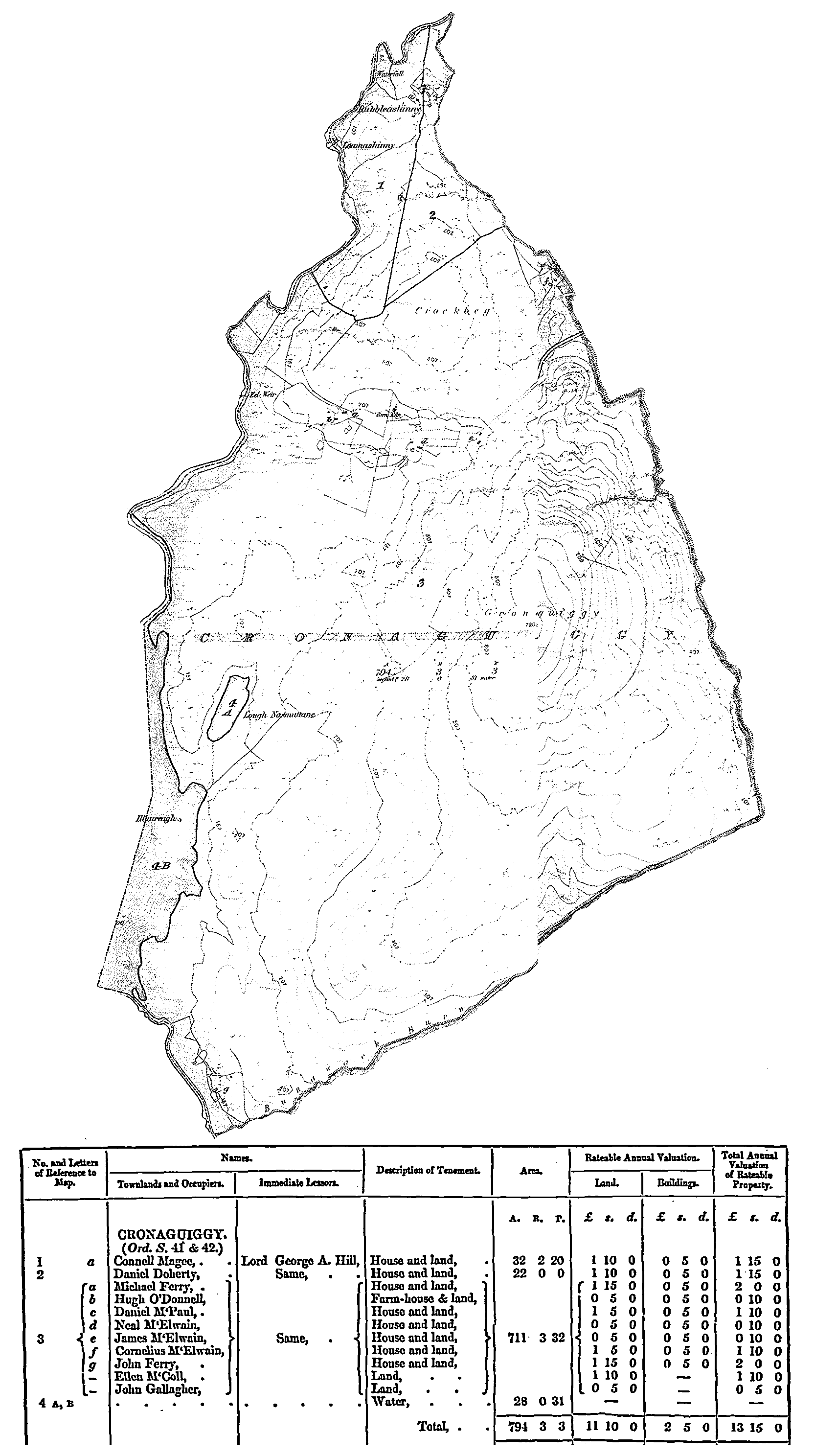
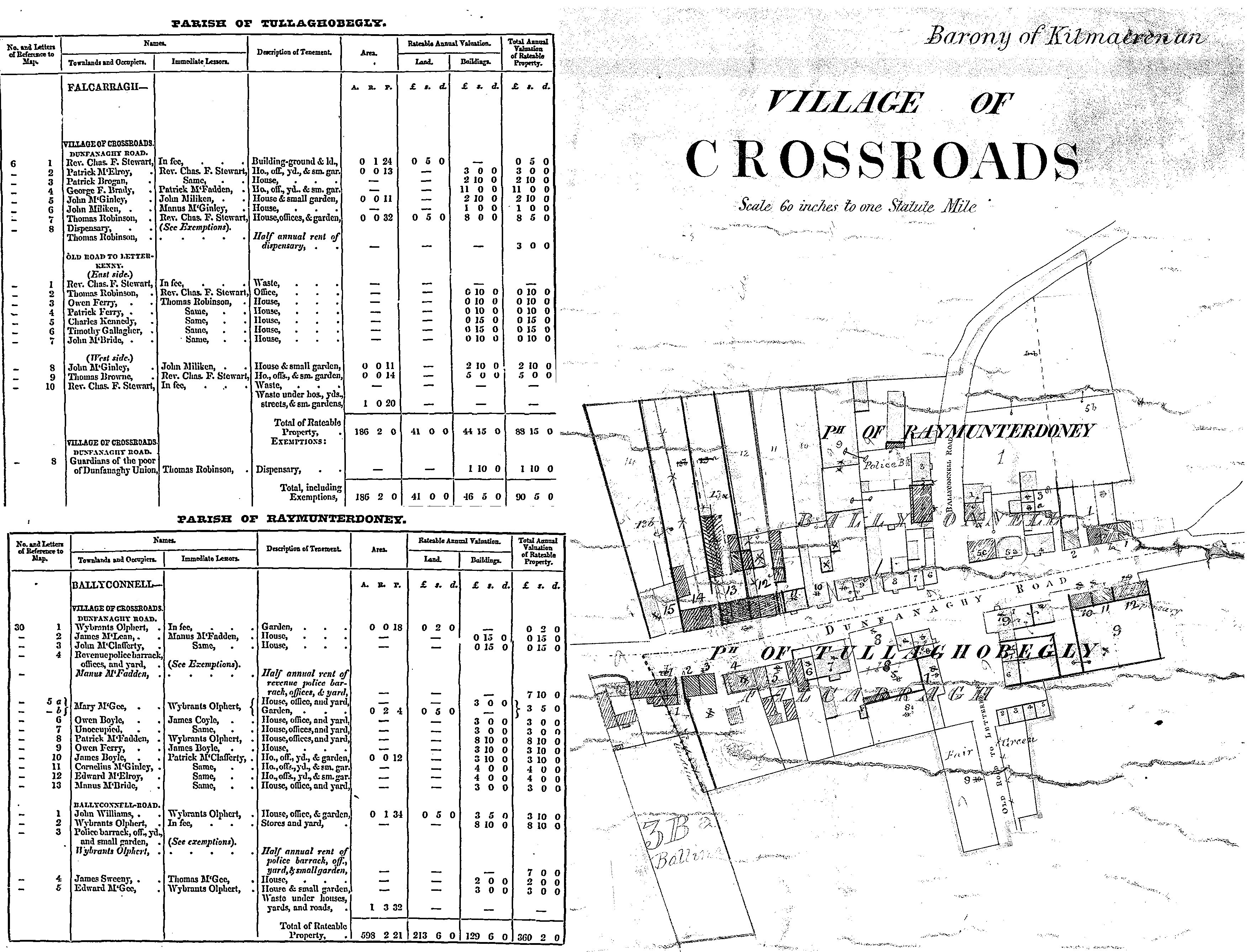
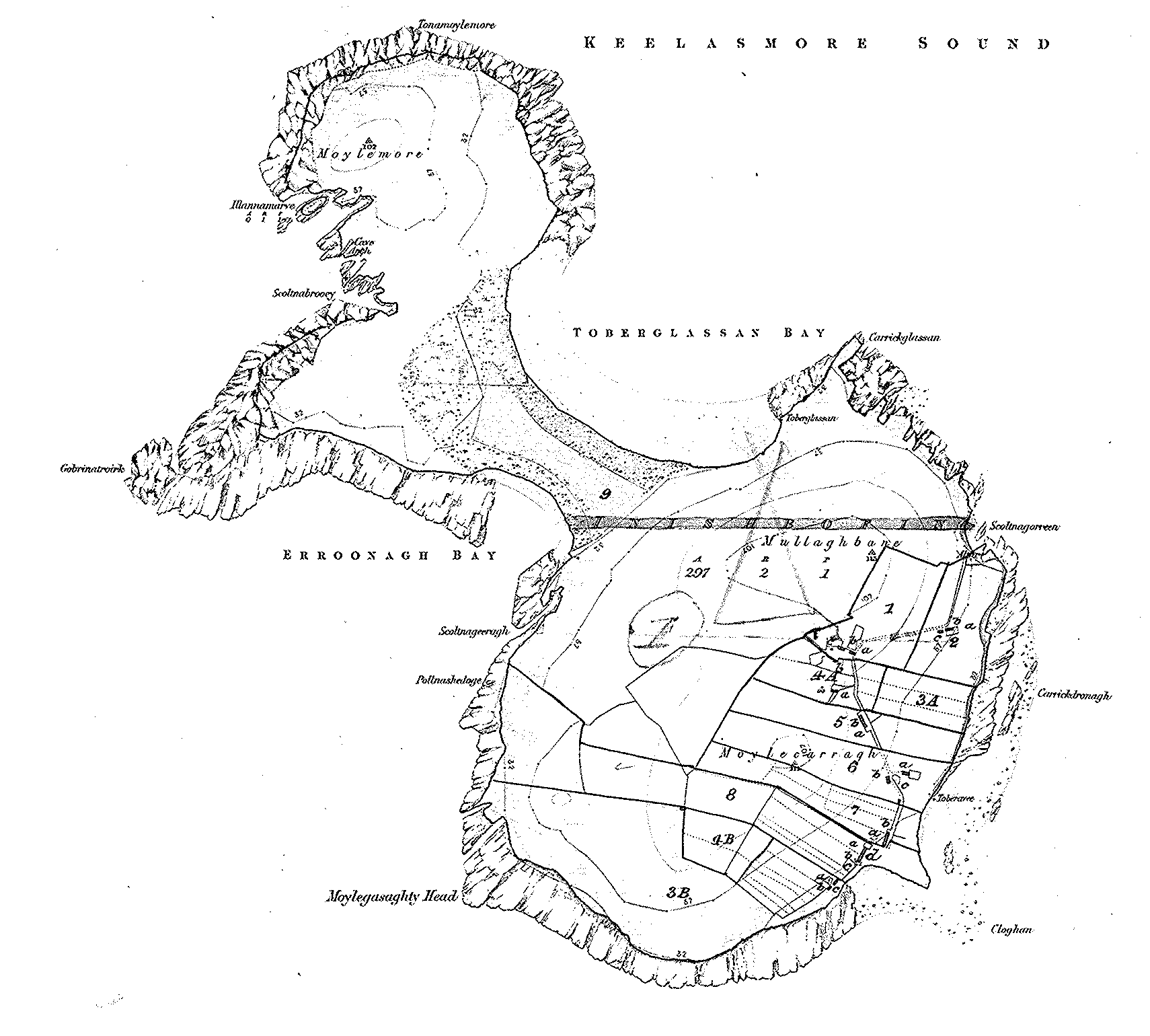
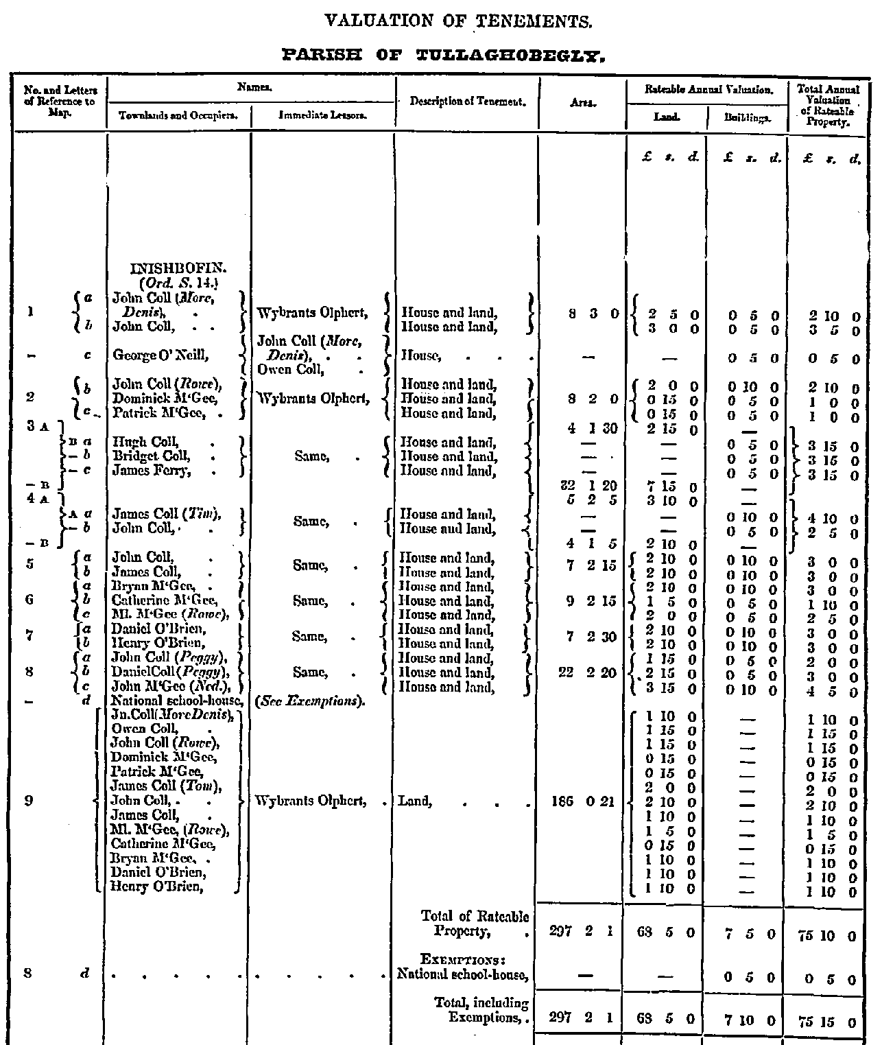
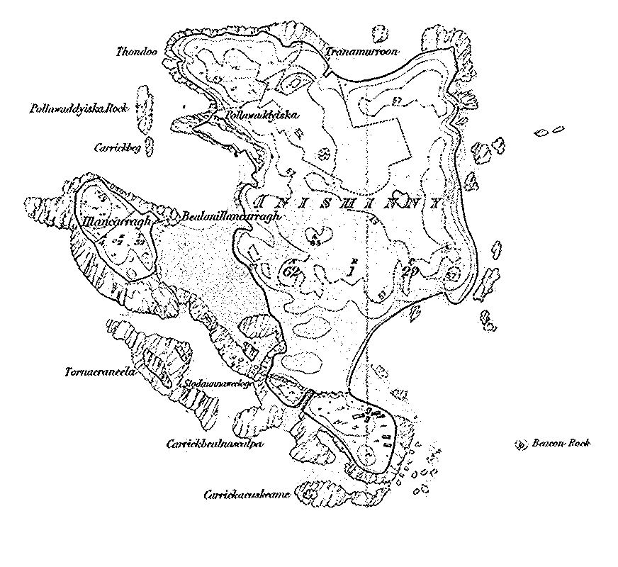
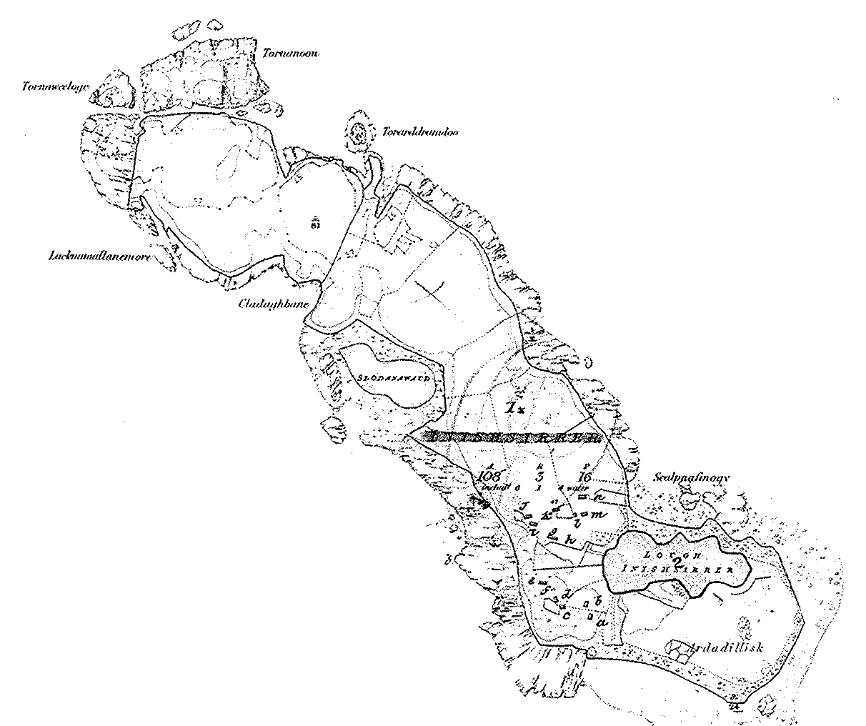
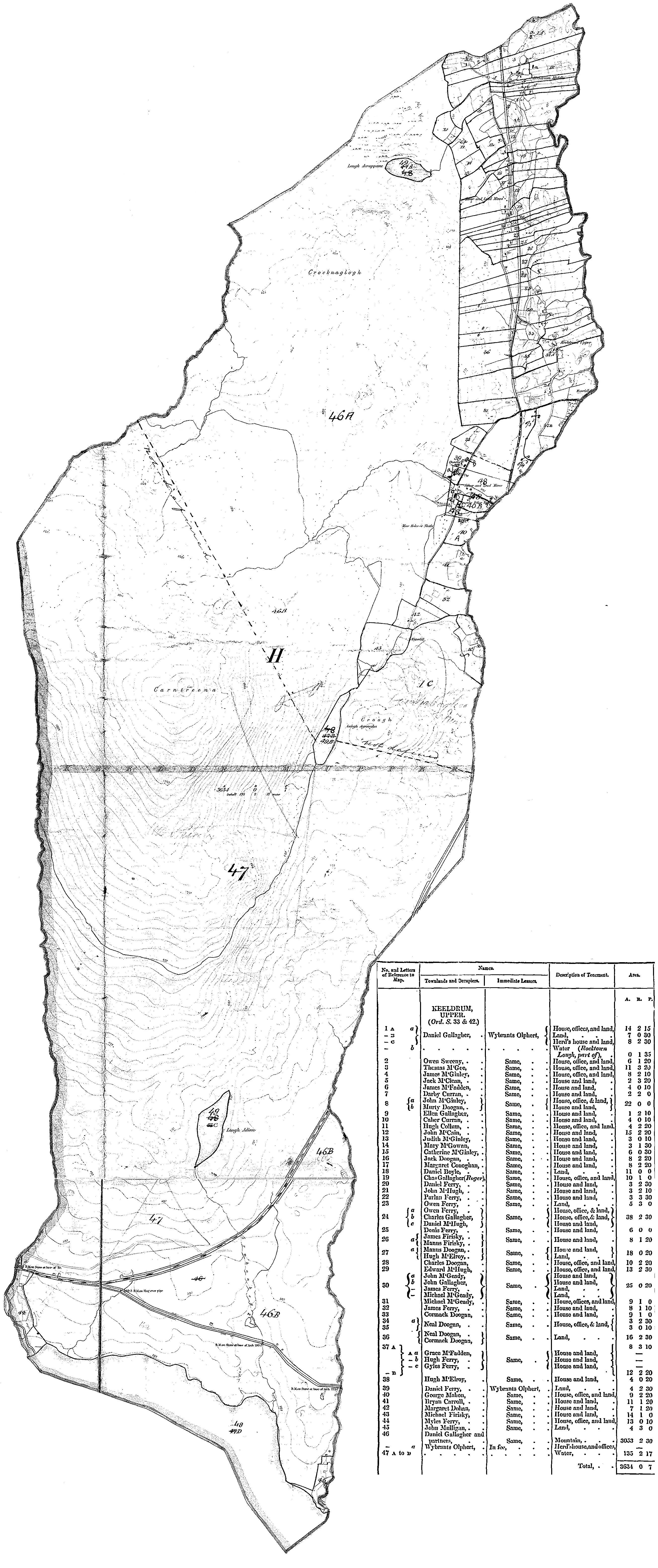
1857 Griffith's Valuation (detailed)
Legal
Links
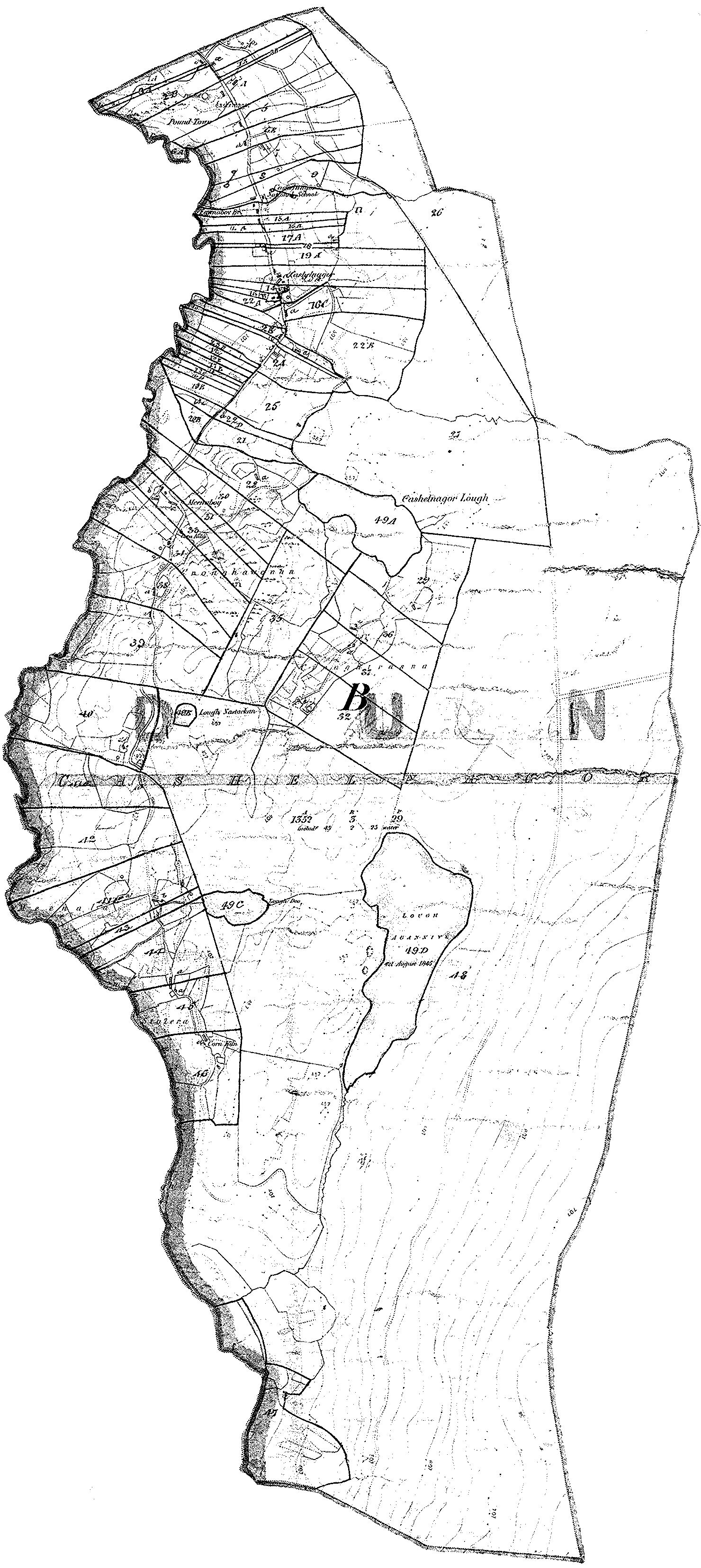
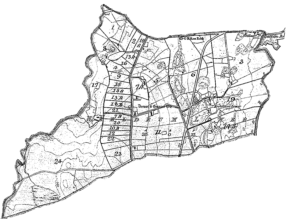
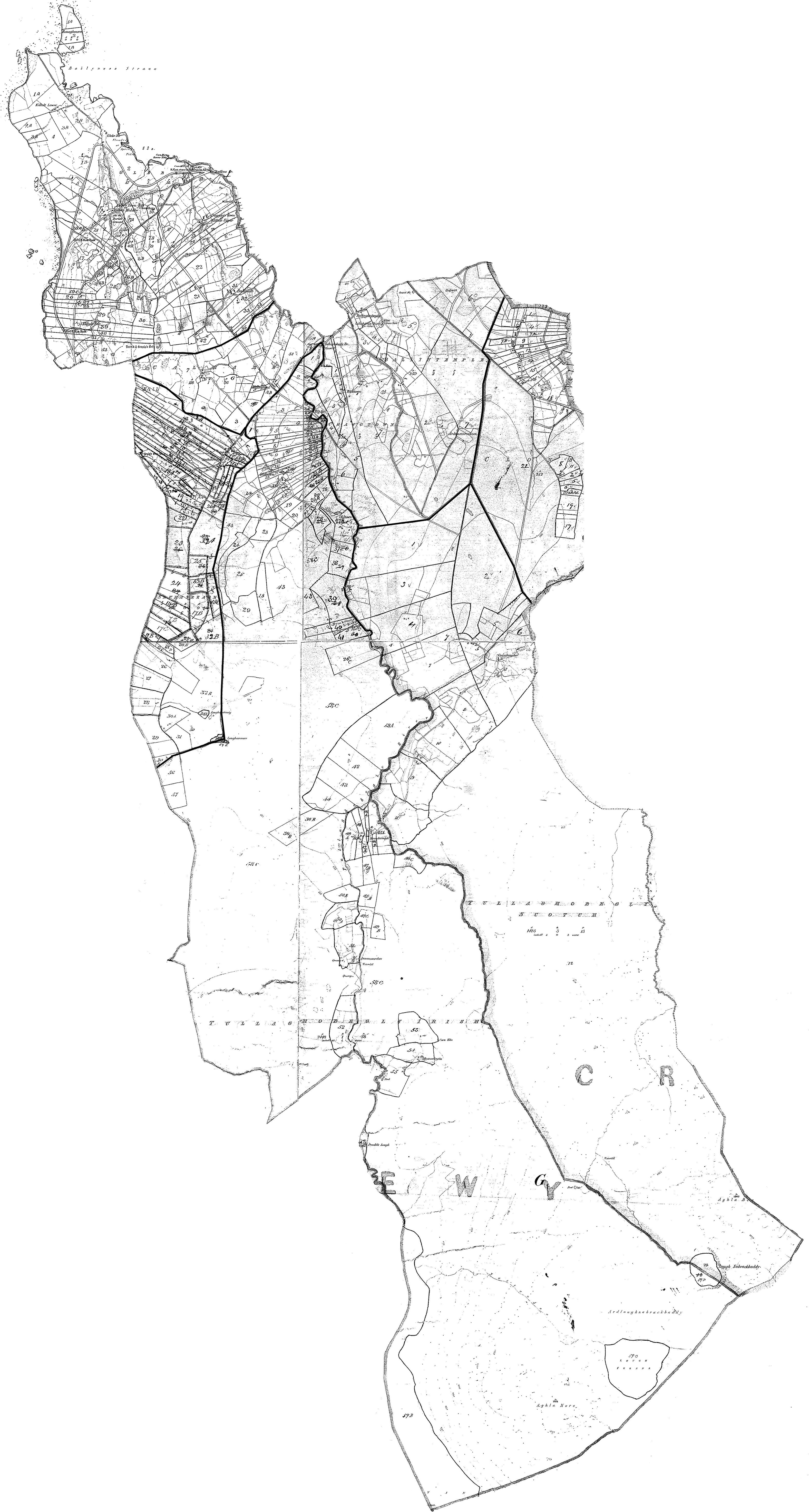
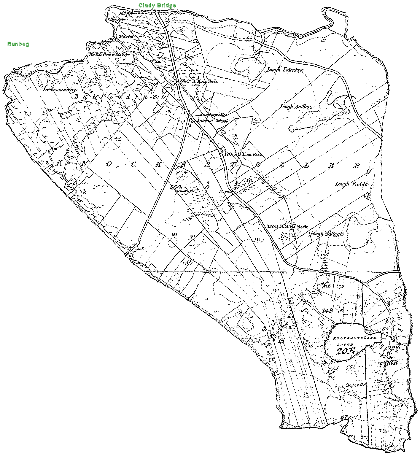
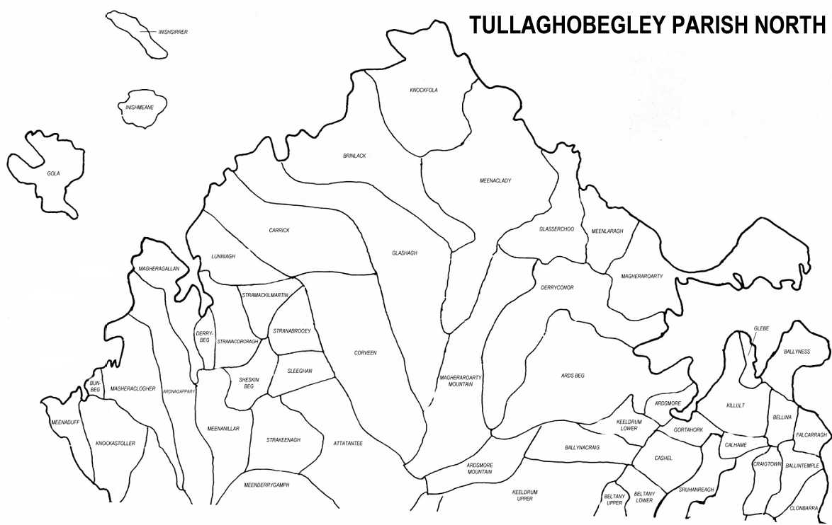
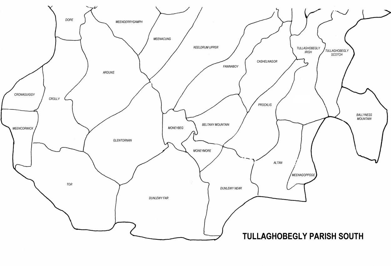
Maps:
Ordnance Survey 1835
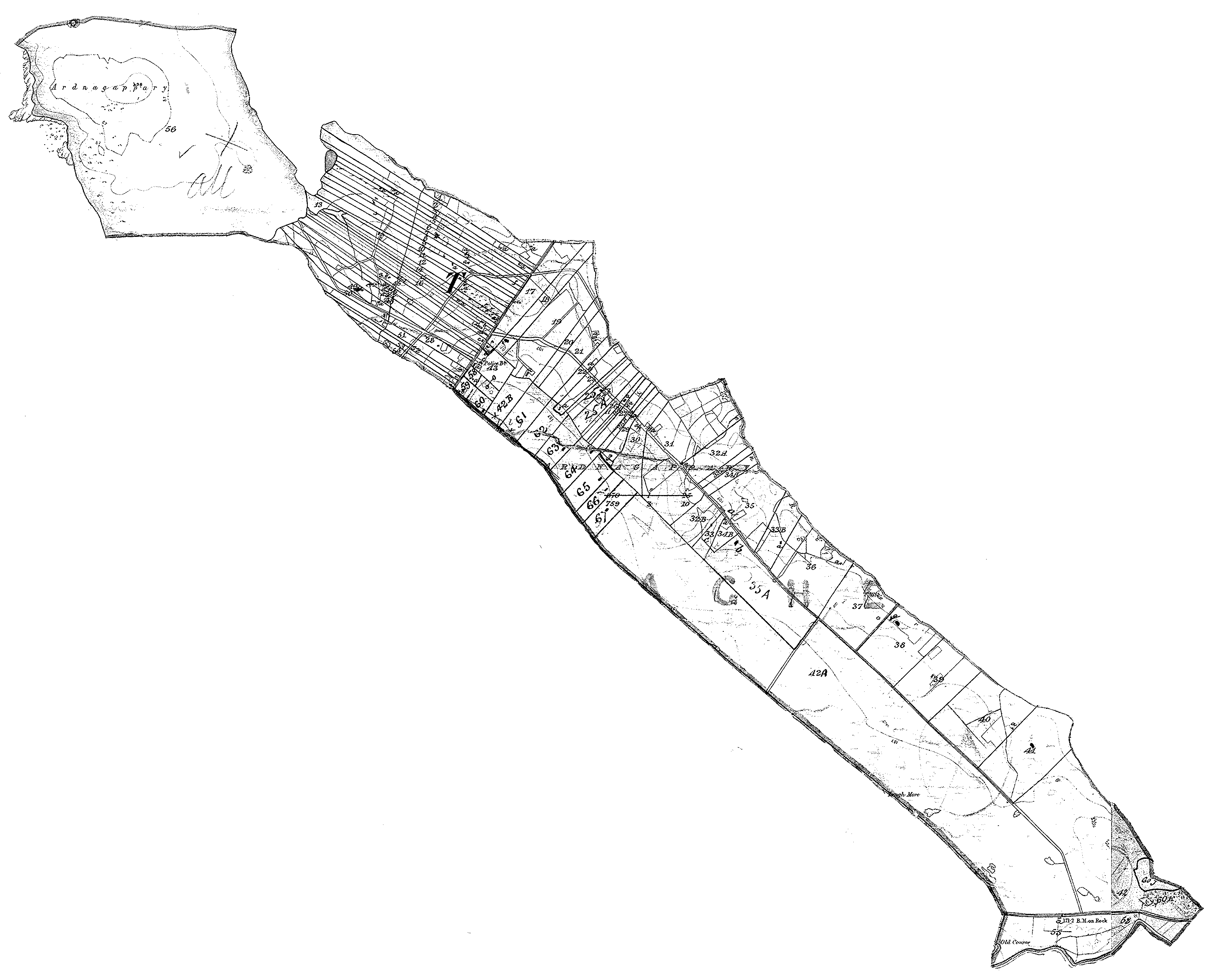
Ardnagappery (with Griffith's Valuation refs - see Valuation above)
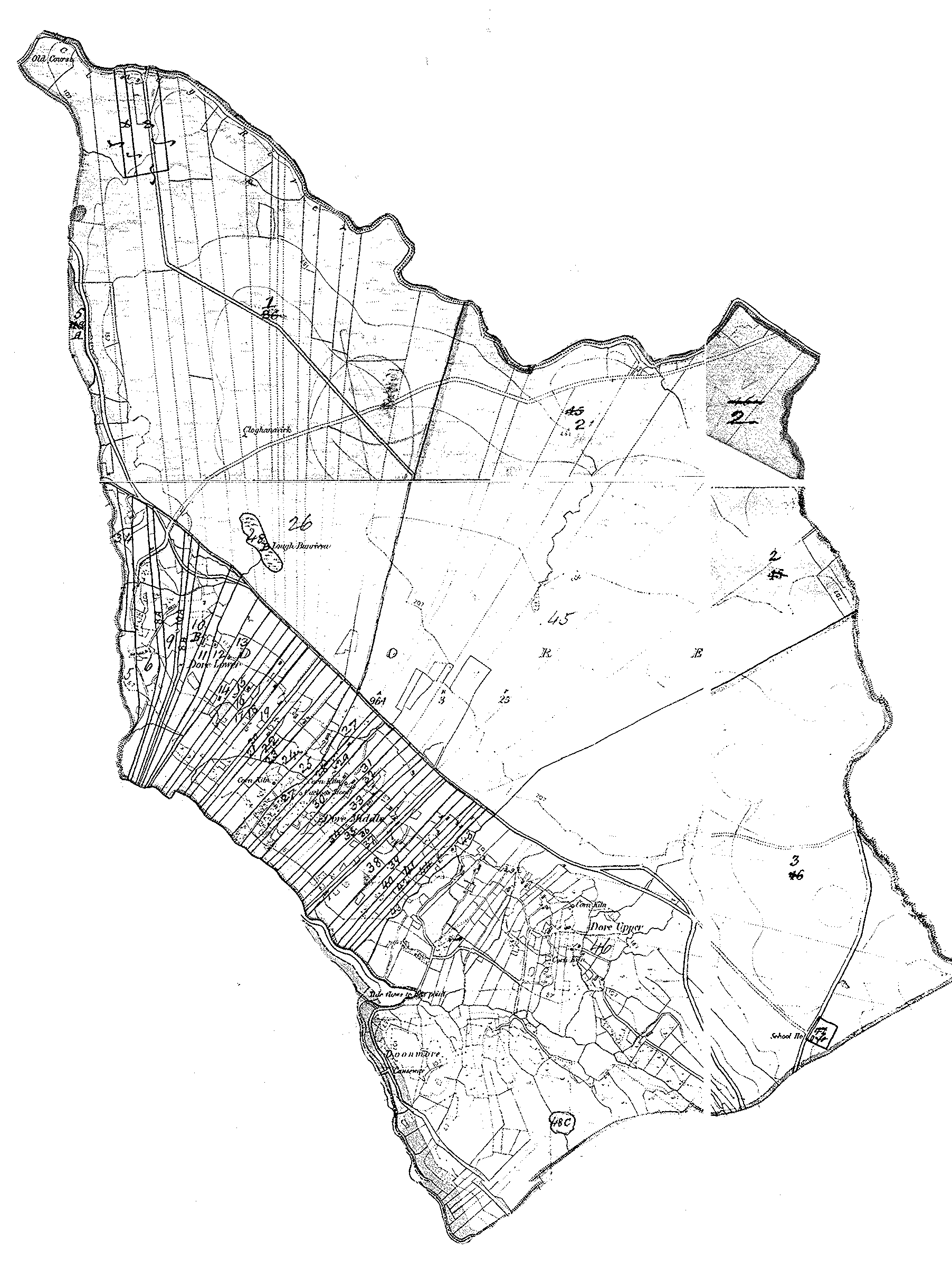
Dore (with Griffith's Valuation refs - see Valuation above)
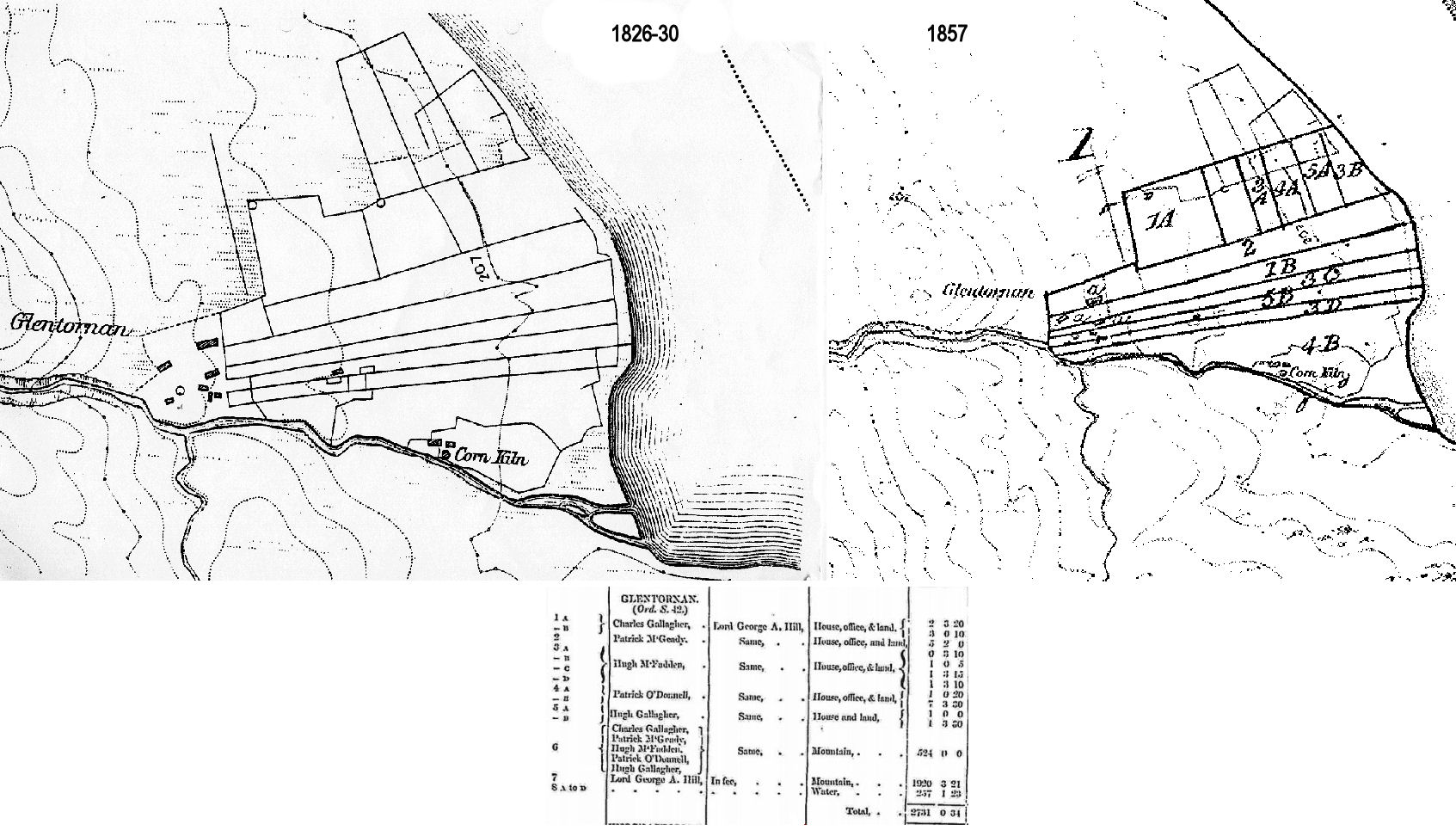
Glentornan (with Griffith's Valuation) (Bernard)
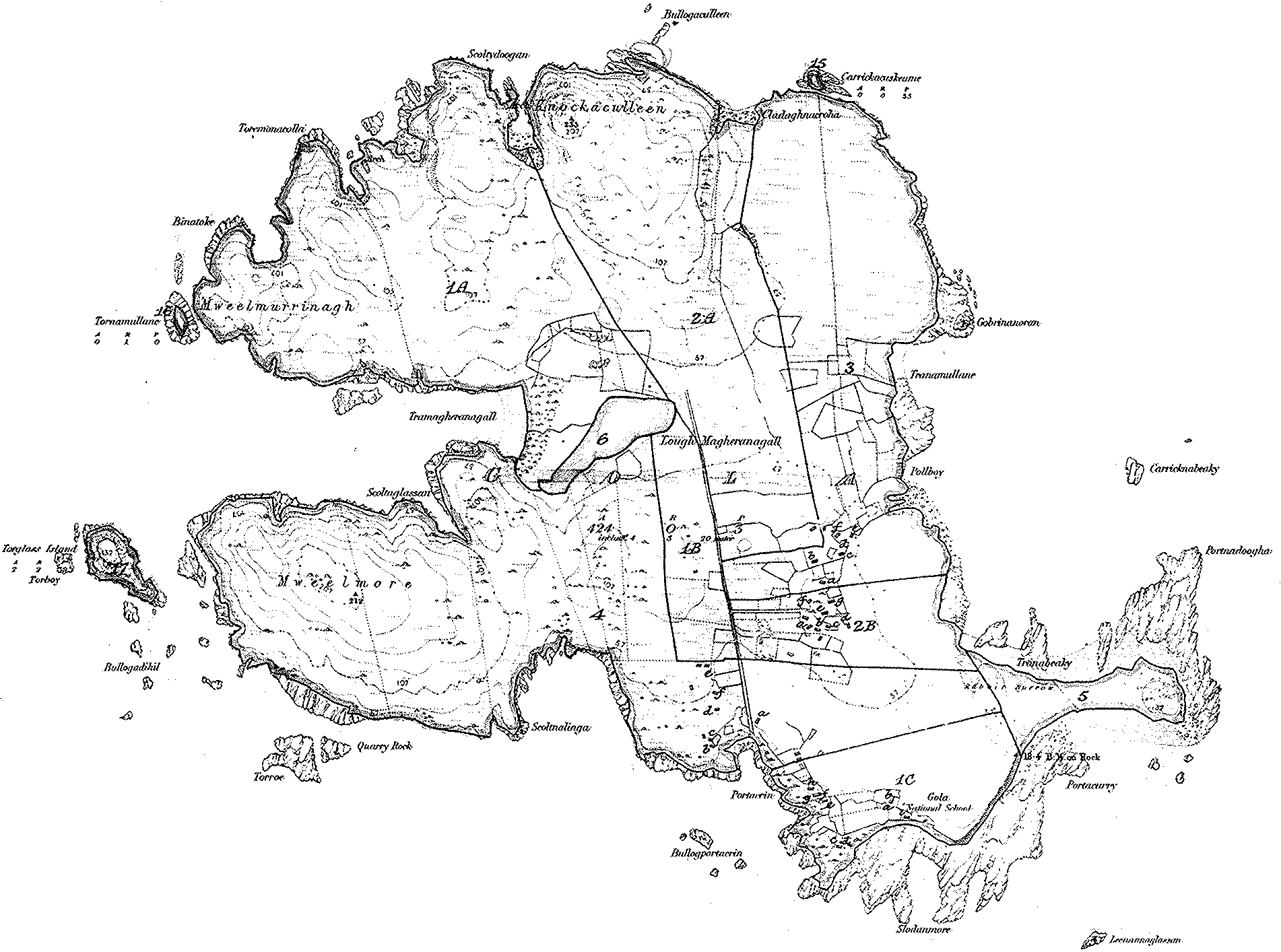
Gola Island (with Griffith's Valuation refs - see Valuation above)
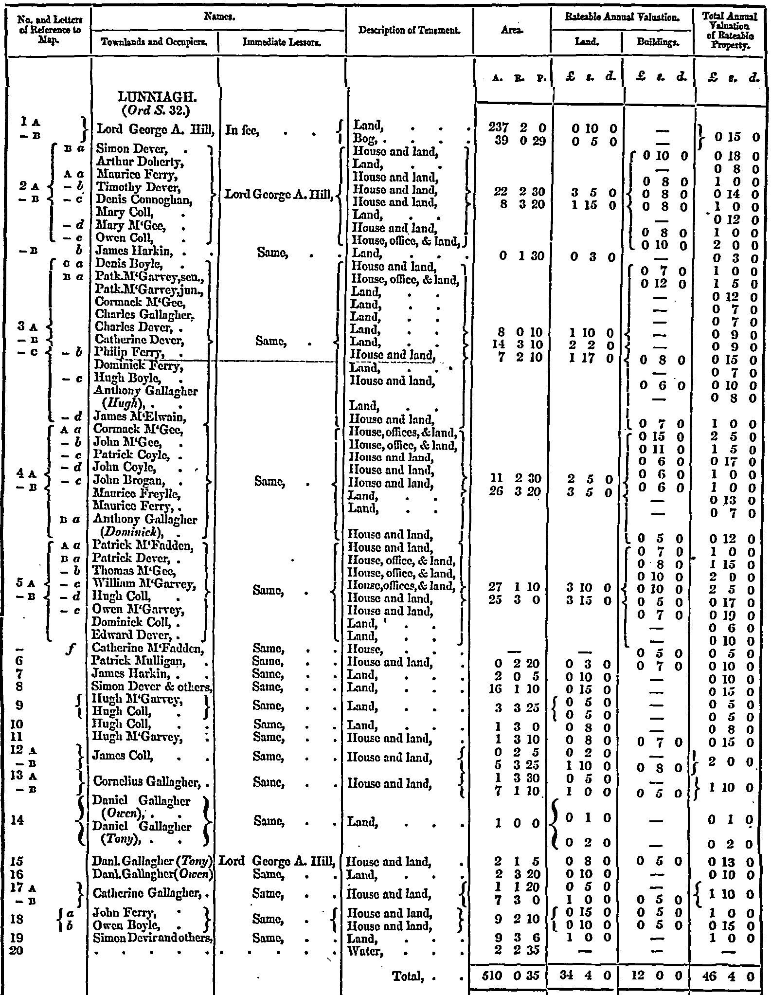
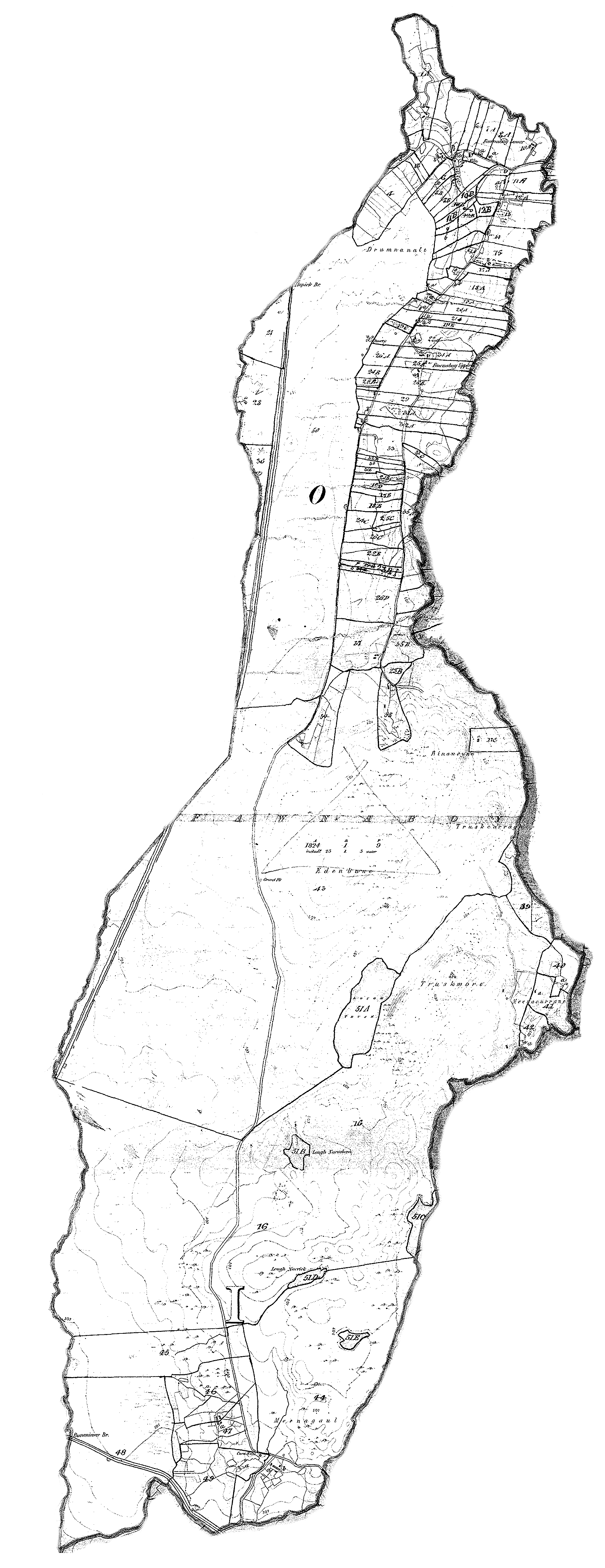
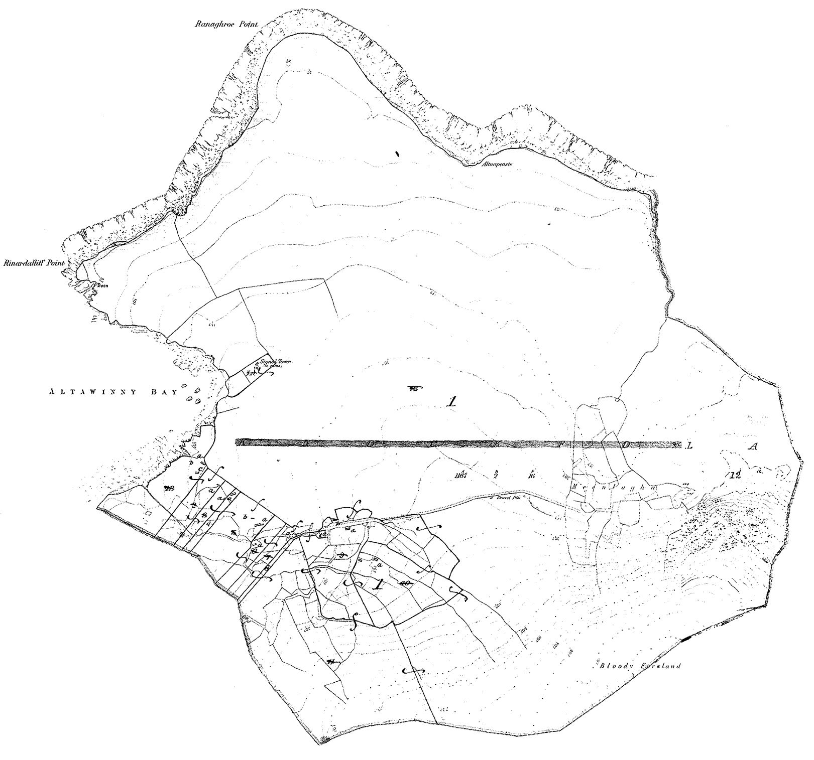
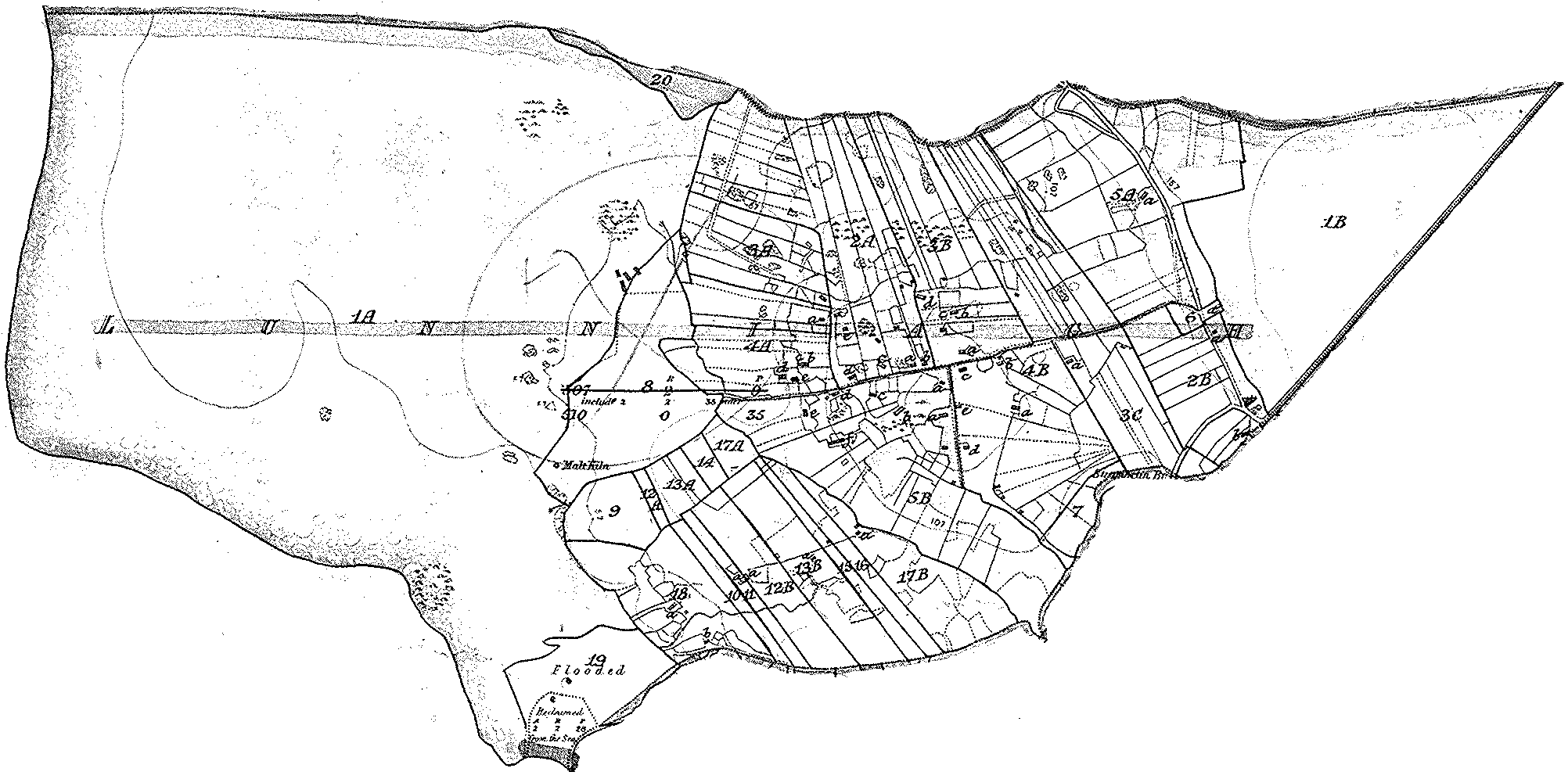
Killult, Sruhanreagh, Tullaghobegly Irish, Tullaghobegly Scotch, Ballintemple, Craigtown & Calhame
Parish
Media:
Music/Video:
Photographs:
Sites
Leo's Tavern (Facebook)
Leo's Tavern (MySpace)
Projects:
Registers:
Dunfanaghy Dog Licence Register - First 200 Dogs registered (1866) new
School Registers
Researchers:
To contact any of these researchers, click on their name
Lyn - Benson & Herraghty in Bellina/Tullaghobegley
Gloria - Benson & Herraghty in Bellina/Tullaghobegley
Isolde - Boyle and Doherty from Magheraclogher
Tom - Brogan & Boyle from Killult, Tullaghobegly Scotch, Tullaghobegly Irish
Mary - Cannon and Gallagher from Cashelnagore
Sean - Cannon in Gortahork
Marie - Coll and McGee in Carrick
Patricia - Coll from Derrybeg
Mike - Coll in Inishbofin
Roseann - Inishbofin families (incl Coll, Curran), McFadden in Magheraroarty
Kathleen - Coyle (Owen/John) from Falcarragh & Rodgers (Sarah/Sally) from Tory Island
Colleen - Dever/Diver/Devers/Divers, Whoriskey & Sweeney on Tory Island
Pat - Diver on Gola
Jannette - Diver, Doohan, Heggarty/Herraghty, McGinley, Mooney, Whorriskey & McClafferty on Tory Island
Pam - Doherty in Magheraclogher
Catherine - Duggan in Derryconor
Anne - Dunlop & O'Donnell on Innismeane, Dunlop & McGee in Magheragallen and Dunlop & Gibbon in Ardnagappery
Bob - Ferry and Sweeney from Knockfola/Bloodyforeland
Liam - Ferry from Money Beg
Marie - Ferry from Knockfola
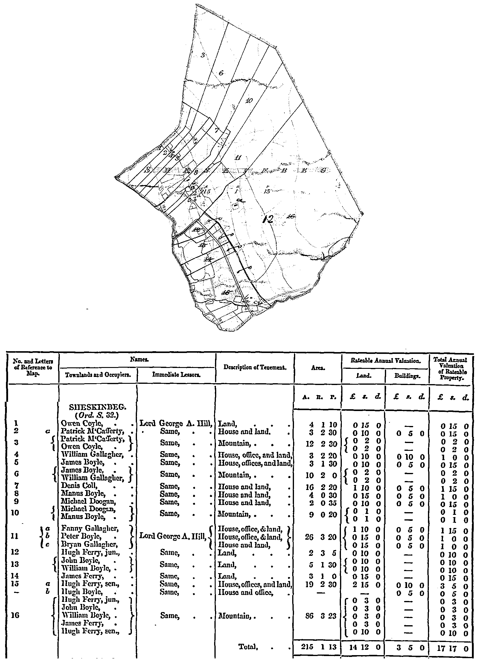
Paul - Ferry and Roarty in Sheskinbeg
Anthony - Freal/Freal in Gweedore and O'Donnel in Dunlewey
Margaret - Friel in Lunnaigh, Magheraclogher & Islands, McGarvey in Tullaghobegley, O'Donnell on Innismeane Island
Alice - Gallagher in Beltany Lower & Upper, and Cashel & O'Donnell in Beltany Upper
Chris - Gallagher & Dixon from Meenlaragh
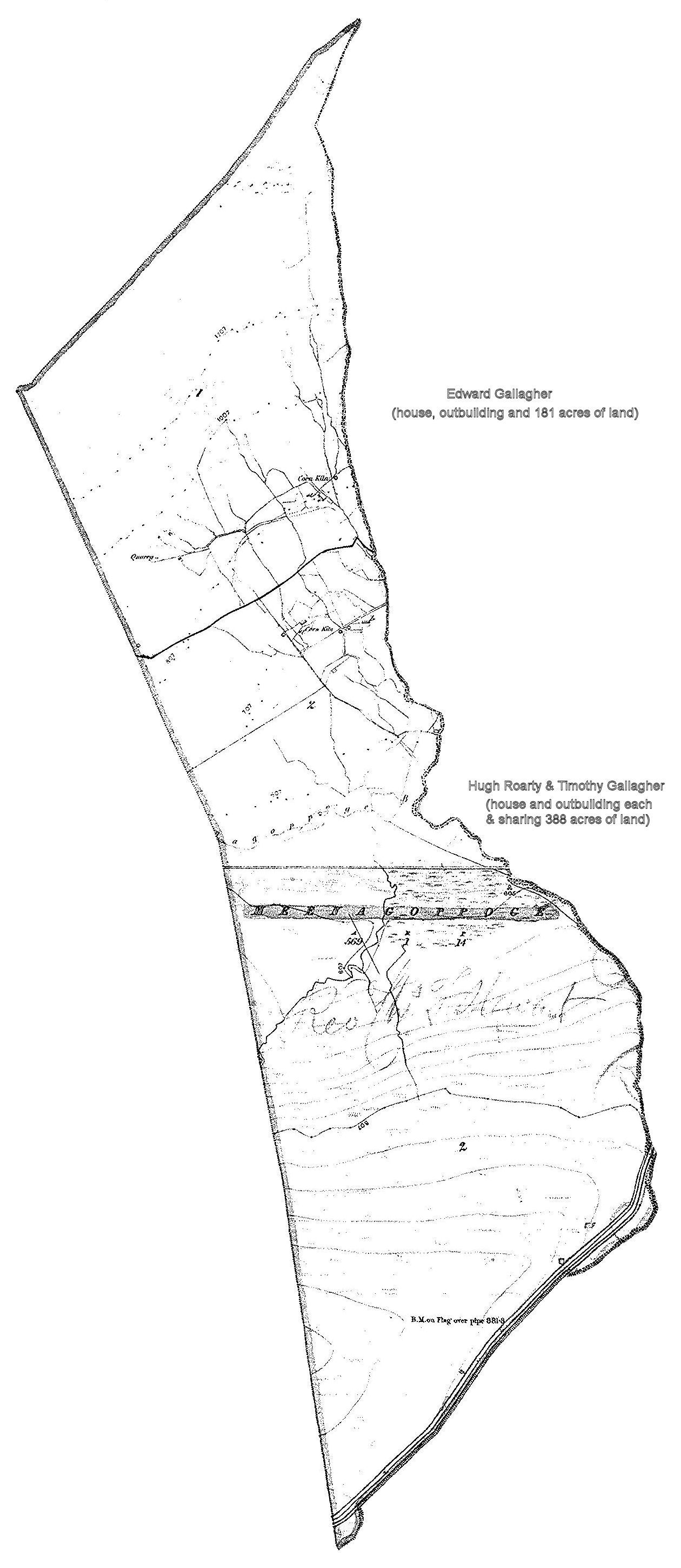
Bernard - Gallagher & McNulty in Craigtown & Rocktown
Francine - Gallagher from Magheragallen
JerryLou - Gallagher, Sweeney from Meenagoppoge
Julie - Gallagher from Dore or Carrick (Francis Gallagher and Mary Sweeney)
Mary - Gallagher in Glentornan
Terry - Gallagher from Bunbeg (Edmud Gallagher & Sophia Logan)
K. Murray - Gallagher from Meenanillar & Coll from Ardnagappery
Moira - Gallagher in Sleeghan & Gweedore, Harkin in Stramartin, Gweedore, Ards Beg Derryconnor & Gortahork, McGinley in Magheralosk, Meenaduff and Gweedore, O'Donnell in Magheraclogher and Gweedore, Sweeney in Ballindrait & Knockalstoller
AStewart - Gillespie in Stranacorkeragh
Kathleen - Harkin in Stramartin, Gweedore, Ards Beg and Gortahork, Ferry in Stranacorkeragh and Gweedore, & Gallagher in Stranabrooey and Gweedore, Magee in Gweedore, O'Donnell in Middletown
Joe - Herrity, Herraghty, Heraghty & Curran in Gortahork, Upper Killult & Calhame
DiHurd - McBride from Arduns
John - McBride in Middletown (Ardnagappary)
Nan - McBride in Ardnagappery
Mary - McCole from Meenanillar, Coll from Sheskinbeg, Boyle from Dore
Maureen - McCole/McCoal in Ardnagappary
Maureen - McCue & McGee in Falcarragh, Crossroads, Meenderry & Tullaghobegley Irish
John - McFadden from Knockfola
Barb - McFadden in Falcarragh
Elaine - McFadden & Rodgers in Ards Beg
Geri - McFadden from Knockfola and Ferry from Brinlack
Ella - McFadden in Bedlam/Keeldrum Lower
Sophia - McFadden in Corveen
Christine - McFadden & O'Donnell from Inishsirrer, O'Donnell from Innismeane, Sweeney from Knockastoller
Sarah - McFadden & Ferry in Brinlack, Dooghan/McGinley and Rodgers in Ardsbeg, McFadden in Knockfola
Catherine - McHugh & McGarvey in Corveen
Shona - McPaul and Sweeney from Meencorwick
Suzanne - Mulheran/Mulheron in Clonbarra
Bill - O'Briens, Doogans/Duggans, Greens & O'Donnells from Bedlam/Keeldrum Lower
Sheila - O'Brien in Glenhola, anybody from Knockfola, including Coyle, O'Brien, McBride and O'Donnell, McGinley and Coyle from CarrickCoyle, O'Donnell from Knockstoller, and O'Donnell on Gola Island, O'Donnell from Cronaguiggy
Bob - O'Brien from Killult
Simon - Smullen and Alcorn from Tullaghobegly
Lorraine - Sweeney and Diver on Gola
Stories
Townlands:
© 1998 Donegal Genealogy Resources